S Bridge, National Road

Why it's listed
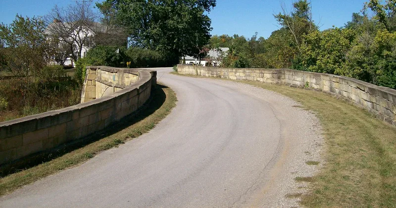
Five miles east of Old Washington, Ohio, a single-arch stone bridge carries an old section of the National Road over a small brook. Built in 1828, it is about 185 feet long with its approaches, rises 18 feet above the water, and measures 26 feet between parapets. The stones are laid in irregular ashlar, with large buttresses at each end of the segmented arch. The straight span is joined by sharply curving approaches, which give the structure its S-shape in plan. It is one of four of its kind remaining in Ohio. Legend credits the design to a tavern wager between an English engineer and an Irish builder, though the likelier reason was that this form of arch was the easiest to build and used the least material. The bridge recalls the road that brought settlers into Ohio and carried its produce east. Though over 130 years old, it remains sound, and state markers at each end explain its history.
Significance in brief: The bridge is argued to represent the National Road in Ohio and retains a great deal of historic integrity. It is one of four S-bridges still standing in Ohio and shows the quality of the road's bridge construction, which carried heavy wagon traffic while the crushed-stone paving wore down. The reviewers noted its engineering value but placed its main significance in its association with the National Road.
Machine-generated summary. This summary was generated by a language model from the official nomination document and has not been reviewed line by line by an editor. It may contain errors. Check the source document before relying on any detail. Source: nomination document (PDF) · National Archives catalog entry. NRHP reference 66000610, listed October 15, 1966. Summary generated October 2026 (model claude-sonnet-5-5, prompt v1.0-2026-10-29, confidence medium).
Key facts
| Address | 4 mi. E of Old Washington on U.S. 40, Old Washington |
|---|---|
| County | Guernsey County |
| Listed | October 15, 1966 |
| Reference number | 66000610 |
| Resource type | Structure |
| Period of significance | 1828-present |
| Areas of significance | Engineering, Communications |
| Level of significance | National |
| National Historic Landmark | Yes, designated January 29, 1964 |
| Status (as stated in the nomination) | Described as structurally sound and unaltered, though stones have begun to fall from the walls and little recent maintenance is apparent. It is rated to carry five tons, and the State of Ohio has placed historical markers at each end. |
| Acreage | 0.9 |
| Coordinates | 40.04526, -81.37414 (NPS GIS) |
What listing means for this property
For a publicly owned building or structure, listing mainly matters when federal funds, permits or licences are involved: projects then go through Section 106 review so effects on the property are considered. Listing also strengthens applications for preservation grants and, for leased income-producing uses, can enable the federal rehabilitation tax credit.
General information, not legal or tax advice. Rules change; confirm with your State Historic Preservation Office or a qualified adviser.
Sources and further reading
- National Park Service, National Register of Historic Places database (snapshot May 2026), reference 66000610.
- Nomination form (PDF, National Archives) — catalog entry
- Wikipedia article (used for cross-checking only; text not reproduced here)
- Wikidata Q7395340
- This listing as JSON
Last updated October 2026. Found an error? See the editorial policy for how to report it.