Lockville Canal Locks

Why it's listed
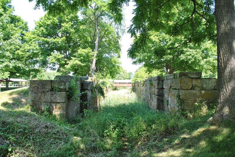
Seven sandstone canal locks and a section of channel near Lockville in Fairfield County, Ohio, remain from the Ohio Canal. Built about 1830 as part of the Ohio-Erie Canal System, which ran from Cleveland to Portsmouth, they saw their first boat on October 7, 1831. Lockville has the largest concentration of locks in Ohio. They sit on a hard stretch of canal where the route fell more than 205 feet through thirty locks and water was scarce, so a feeder ditch was dug. Several locks were rebuilt in 1862-63 under a contract held by Samuel Doyle. The canal was abandoned early in the 20th century, and the State of Ohio sold the locks and right of way in 1916. Today the stone walls survive, though the gates are gone, the channel is largely filled in, and one lock has partly collapsed. The locks reflect how canals lowered shipping costs for goods reaching Ohio markets before railroads became widespread.
Significance in brief: The locks were part of the Ohio-Erie Canal System, and Lockville has the largest concentration of locks in Ohio. They lay in a difficult stretch of the canal that dropped over 205 feet through thirty locks. The canals gave central and southern Ohio a cheap way to move goods before railroads spread.
Machine-generated summary. This summary was generated by a language model from the official nomination document and has not been reviewed line by line by an editor. It may contain errors. Check the source document before relying on any detail. Source: nomination document (PDF) · National Archives catalog entry. NRHP reference 74001480, listed September 10, 1974. Summary generated October 2026 (model claude-sonnet-5-5, prompt v1.0-2026-10-29, confidence high).
Key facts
| Address | Off Pickerington-Lockville Rd., Lockville |
|---|---|
| County | Fairfield County |
| Listed | September 10, 1974 |
| Reference number | 74001480 |
| Resource type | Structure |
| Period of significance | 1830's-1880's |
| Architect / builder | Samuel Doyle (contractor for rebuilding of several locks, 1862-63) |
| Areas of significance | Transportation |
| Level of significance | State |
| Status (as stated in the nomination) | Condition listed as deteriorated and altered. Lock gates are missing, and the walls of most locks are intact. Lock 12 has a partly collapsed wall, and lock 14 has been converted to an animal pen. The canal channel is mostly filled in. |
| Acreage | 16 |
| Coordinates | 39.82095, -82.74177 (NPS GIS) |
What listing means for this property
National Register listing is honorary: it recognises significance and does not restrict what a private owner may do without federal money or permits. It unlocks the 20% federal rehabilitation tax credit for income-producing buildings, state credits in many states, and Section 106 review when federal agencies are involved. See what listing means in practice.
General information, not legal or tax advice. Rules change; confirm with your State Historic Preservation Office or a qualified adviser.
Sources and further reading
- National Park Service, National Register of Historic Places database (snapshot May 2026), reference 74001480.
- Nomination form (PDF, National Archives) — catalog entry
- Wikidata Q137802649
- This listing as JSON
Last updated October 2026. Found an error? See the editorial policy for how to report it.