Morgan, John H., Surrender Site

Why it's listed
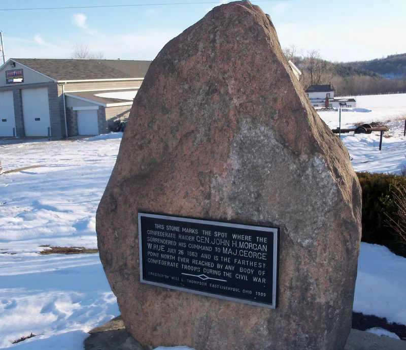
A small roadside park on Ohio Route 518, about three miles west of West Point, marks the place where Confederate cavalry general John Hunt Morgan surrendered on July 26, 1863. Morgan had crossed the Ohio River into Indiana on July 8 with 2,400 men, then led them through southern Indiana and Ohio. After his attempt to recross the river at Buffington failed, he turned inland with about 400 men and surrendered to Captain Burbick, commander of a local militia unit, hoping for better terms. Those terms were later revoked, and Morgan was imprisoned in Columbus. The site is notable because it represents the farthest north that any large Confederate force reached, roughly 60 miles beyond Gettysburg. The raid also disrupted communications and drew some 28,000 Union troops from Eastern Tennessee. A rough-hewn stone marker erected in 1908, with a brass plaque, now stands on the spot.
Significance in brief: The site marks the end of Morgan's raid through Indiana and Ohio in July 1863. It is the northernmost point reached by any large body of Confederate troops, about 60 miles farther north than Gettysburg. The raid also disrupted communications and diverted some 28,000 Union troops from the Eastern Tennessee front.
Machine-generated summary. This summary was generated by a language model from the official nomination document and has not been reviewed line by line by an editor. It may contain errors. Check the source document before relying on any detail. Source: nomination document (PDF) · National Archives catalog entry. NRHP reference 73001401, listed April 23, 1973. Summary generated October 2026 (model claude-sonnet-5-5, prompt v1.0-2026-10-29, confidence high).
Key facts
| Address | 3.1 mi. W of West Point on OH 518, West Point |
|---|---|
| County | Columbiana County |
| Listed | April 23, 1973 |
| Reference number | 73001401 |
| Resource type | Site |
| Period of significance | July 26, 1863 (19th Century) |
| Areas of significance | Military |
| Level of significance | National |
| Status (as stated in the nomination) | Condition is listed as good and altered, on its original site. It is a roadside park owned by the State of Ohio, with a stone marker and brass plaque. |
| Acreage | 0.1 |
| Coordinates | 40.69813, -80.74698 (NPS GIS) |
What listing means for this property
Sites (archaeological sites, battlefields, landscapes) are often listed with a restricted address to protect them from looting or disturbance. Listing is honorary for private owners; federal undertakings on or near the site go through Section 106 review, and state laws may protect burials and artefacts regardless of listing.
General information, not legal or tax advice. Rules change; confirm with your State Historic Preservation Office or a qualified adviser.
Sources and further reading
- National Park Service, National Register of Historic Places database (snapshot May 2026), reference 73001401.
- Nomination form (PDF, National Archives) — catalog entry
- Wikipedia article (used for cross-checking only; text not reproduced here)
- Wikidata Q6236995
- This listing as JSON
Last updated October 2026. Found an error? See the editorial policy for how to report it.