Blaine Hill "S" Bridge
Also known as: Blaine Bridge; Blaine Hill Bridge

Why it's listed
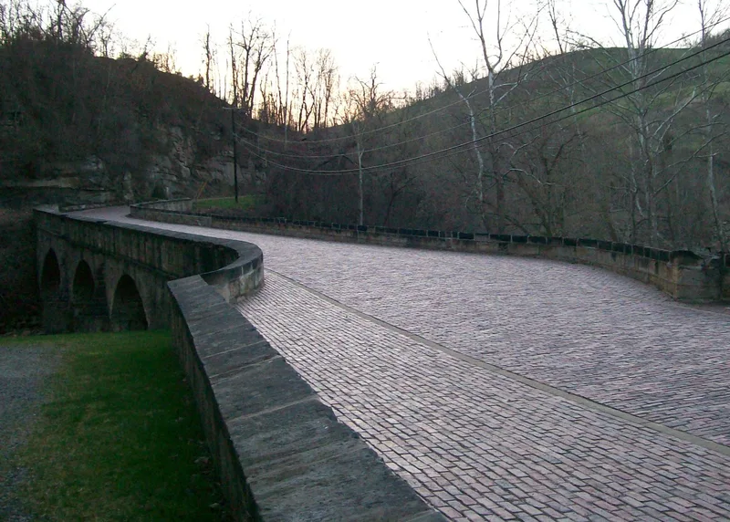
Carrying the old National Road across Wheeling Creek at Blaine, Ohio, this 356-foot sandstone bridge has three arches of 30, 40 and 50 feet and a curving plan that gives it the name "S" bridge. Completed in 1826, it sits at the foot of Blaine Hill, the steepest rise on the road in Ohio, and the curve gave travelers a longer, gentler approach while keeping the bridge square to the creek. It served traffic until a high-level concrete viaduct bypassed it in 1933, then carried a township road until 1994. Floodwaters collapsed part of the largest arch in 1998. The arch was rebuilt, and a 2004-2005 rehabilitation added concrete arches over the stone ones, repaired the spandrel walls and repaved the deck in brick. The bridge was listed for its link to the National Road and as a notable example of early stone arch engineering built from local materials. It now serves pedestrians.
Significance in brief: The bridge is significant under Criterion A as a segment of the National Road, which aided settlement of Ohio and served travelers for over a century. It is significant under Criterion C as an example of early stone arch bridge-building on the frontier, using local stone and a curved design to ease the steep approach to Blaine Hill. It retains most character-defining features such as arch rings, spandrel walls, parapets and piers.
Machine-generated summary. This summary was generated by a language model from the official nomination document and has not been reviewed line by line by an editor. It may contain errors. Check the source document before relying on any detail. Source: nomination document (PDF) · National Archives catalog entry. NRHP reference 10000082, listed March 17, 2010. Summary generated October 2026 (model claude-sonnet-5-5, prompt v1.0-2026-10-29, confidence high).
Key facts
| Address | Township Rd. 649, Blane, Pease Township |
|---|---|
| County | Belmont County |
| Listed | March 17, 2010 |
| Reference number | 10000082 |
| Resource type | Structure |
| Period of significance | 1826-1933 |
| Architectural style | No Style |
| Criteria |
|
| Areas of significance | Transportation, Exploration/Settlement, Engineering |
| Level of significance | State |
| Status (as stated in the nomination) | Restored in 2004-2005 after a 1998 arch collapse; closed to vehicles, blocked by bollards, and open to pedestrians. Plans exist for a historical park. |
| Acreage | 0.9 |
| Coordinates | 40.06692, -80.82083 (NPS GIS) |
What listing means for this property
For a publicly owned building or structure, listing mainly matters when federal funds, permits or licences are involved: projects then go through Section 106 review so effects on the property are considered. Listing also strengthens applications for preservation grants and, for leased income-producing uses, can enable the federal rehabilitation tax credit.
General information, not legal or tax advice. Rules change; confirm with your State Historic Preservation Office or a qualified adviser.
Sources and further reading
- National Park Service, National Register of Historic Places database (snapshot May 2026), reference 10000082.
- Nomination form (PDF, National Archives) — catalog entry
- Wikipedia article (used for cross-checking only; text not reproduced here)
- Wikidata Q4923948
- This listing as JSON
Last updated October 2026. Found an error? See the editorial policy for how to report it.