Kidwell Covered Bridge

Why it's listed
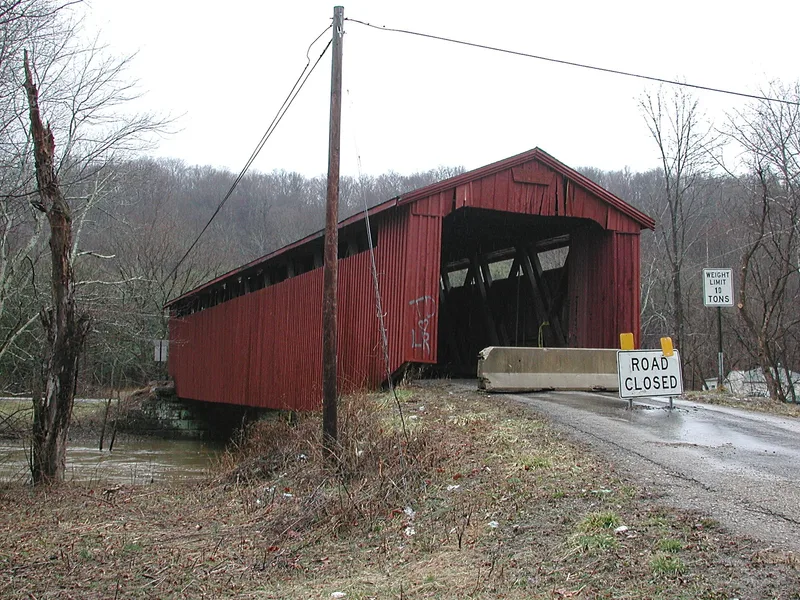
Spanning Sunday Creek on Monsrat Road, one mile north of Truetown, this covered bridge was built in 1880 after a flood washed out an earlier crossing. It is a ten-panel Howe truss, about 96 feet long, with vertical board siding, straight portals, cut-stone abutments and a metal roof that likely replaced shingles. The Howe design, patented in 1840, used iron tension rods that could be tightened to straighten and strengthen the structure. The bridge takes its name from the Kidwell family, whose grist and saw mills operated nearby from 1839. Other neighbors included Weethee College, a small academy founded in 1865, and the Montserrat coal mine, the likely source of the road name. The mills, college and mine are gone, yet the bridge remains in good condition, painted deep red, and carries daily traffic between two state routes. Local residents regard it as a landmark and a reminder of the area's pioneer past.
Significance in brief: The bridge is a surviving example of the Howe truss, a design that used iron tension rods in place of wooden verticals. It replaced an earlier bridge lost to a flood and still carries daily traffic. It is also a local landmark tied to nearby mills, a small academy and a coal mine of the late 1800s.
Machine-generated summary. This summary was generated by a language model from the official nomination document and has not been reviewed line by line by an editor. It may contain errors. Check the source document before relying on any detail. Source: nomination document (PDF) · National Archives catalog entry. NRHP reference 77001042, listed April 11, 1977. Summary generated October 2026 (model claude-sonnet-5-5, prompt v1.0-2026-10-29, confidence high).
Key facts
| Address | 1 mi. N of Truetown, Truetown |
|---|---|
| County | Athens County |
| Listed | April 11, 1977 |
| Reference number | 77001042 |
| Resource type | Structure |
| Period of significance | 1880 |
| Architectural style | Howe truss covered bridge |
| Areas of significance | Engineering, Transportation |
| Level of significance | State |
| Status (as stated in the nomination) | Stated to be in good condition, unaltered on its original cut-stone abutments, and still carrying daily traffic; the metal roof is a probable replacement for the original shingles. |
| Acreage | 0.9 |
| Coordinates | 39.45577, -82.10358 (NPS GIS) |
What listing means for this property
For a publicly owned building or structure, listing mainly matters when federal funds, permits or licences are involved: projects then go through Section 106 review so effects on the property are considered. Listing also strengthens applications for preservation grants and, for leased income-producing uses, can enable the federal rehabilitation tax credit.
General information, not legal or tax advice. Rules change; confirm with your State Historic Preservation Office or a qualified adviser.
Sources and further reading
- National Park Service, National Register of Historic Places database (snapshot May 2026), reference 77001042.
- Nomination form (PDF, National Archives) — catalog entry
- Wikipedia article (used for cross-checking only; text not reproduced here)
- Wikidata Q58904061
- This listing as JSON
Last updated October 2026. Found an error? See the editorial policy for how to report it.