Miami And Erie Canal, Deep Cut

Why it's listed
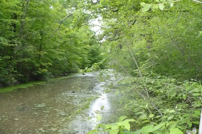
The Deep Cut is a preserved stretch of the Miami and Erie Canal about two miles south of Spencerville, Ohio, beside State Route 66. The canal was begun in 1825 and ultimately ran 248 miles from Cincinnati to Toledo by way of Dayton. At this location, laborers dug a ditch about 6,600 feet long and from five to 52 feet deep through a ridge of blue clay between the St. Marys and Auglaize watersheds. Local farmers, Irish immigrants and convicts worked with picks, shovels, barrows and blasting powder. The nomination describes it as the greatest excavation on the canal. Today the ditch holds water and the towpath remains visible. The State of Ohio owns the site, which includes a rest stop, picnic area, shelter and interpretive material. The canal's importance lay in cheap transportation that helped settle western Ohio, raised land values and gave farm goods an outlet, until railroads reduced its value by the 1860s.
Significance in brief: The Deep Cut was the largest excavation on the Miami and Erie Canal, dug through a ridge of blue clay separating the St. Marys and Auglaize watersheds. It illustrates the effort Ohioans made to build the canal system that helped settle western Ohio, raised land values and gave farmers a way to ship goods. It was recognized as a National Historic Landmark in 1964.
Machine-generated summary. This summary was generated by a language model from the official nomination document and has not been reviewed line by line by an editor. It may contain errors. Check the source document before relying on any detail. Source: nomination document (PDF) · National Archives catalog entry. NRHP reference 66000603, listed October 15, 1966. Summary generated October 2026 (model claude-sonnet-5-5, prompt v1.0-2026-10-29, confidence medium).
Key facts
| Address | 2 mi. S of Spencerville on OH 66, Spencerville |
|---|---|
| County | Allen County |
| Listed | October 15, 1966 |
| Reference number | 66000603 |
| Resource type | Structure |
| Period of significance | 1825-1860 |
| Areas of significance | Industry, Commerce |
| Level of significance | National |
| National Historic Landmark | Yes, designated January 29, 1964 |
| Status (as stated in the nomination) | Owned by the State of Ohio and maintained as a public rest stop and park; condition marked fair on the form, though the text describes the section as in very good condition. The canal is water-filled and the towpath is visible. |
| Acreage | 2 |
| Coordinates | 40.68751, -84.36535 (NPS GIS) |
What listing means for this property
National Register listing is honorary: it recognises significance and does not restrict what a private owner may do without federal money or permits. It unlocks the 20% federal rehabilitation tax credit for income-producing buildings, state credits in many states, and Section 106 review when federal agencies are involved. See what listing means in practice.
General information, not legal or tax advice. Rules change; confirm with your State Historic Preservation Office or a qualified adviser.
Sources and further reading
- National Park Service, National Register of Historic Places database (snapshot May 2026), reference 66000603.
- Nomination form (PDF, National Archives) — catalog entry
- Wikipedia article (used for cross-checking only; text not reproduced here)
- Wikidata Q6827484
- This listing as JSON
Last updated October 2026. Found an error? See the editorial policy for how to report it.