Buckeye Station

Why it's listed
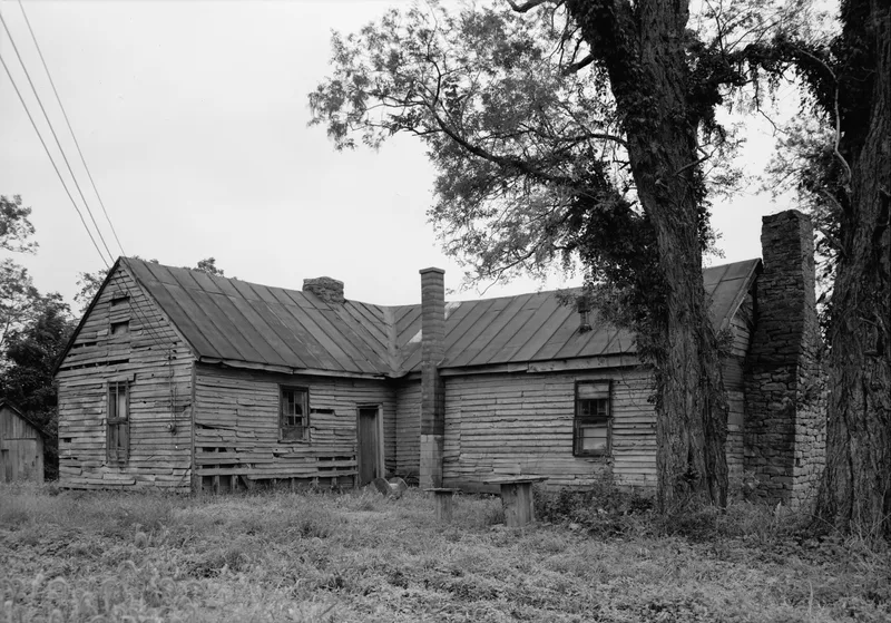
Buckeye Station is an L-shaped, 1 1/2 story house set near the edge of a hill above the Ohio River, roughly four miles east of Manchester in Adams County, Ohio. General Nathaniel Massie, a surveyor and early settler who had founded a stockaded village at present-day Manchester, built it in 1797. He placed it on the site of an earlier buckeye-log house of the same name, which he removed. The present house is of braced-frame construction, with stone fireplaces, a central chimney, and traces of hand-riven clapboards fastened with forged nails. Its alterations over time have been minor. Judge Charles W. Byrd lived there by 1807, and the Ellison family acquired it in 1818. It was listed as the oldest documented braced frame building remaining in Ohio and for its link to Massie. Its isolated setting and deteriorating framing left its future uncertain at the time of listing.
Significance in brief: The nomination argues architectural significance because it is the oldest documented braced frame building remaining in Ohio. It also has historical significance as the work of Nathaniel Massie, a prominent surveyor and early settler of the Ohio Country.
Machine-generated summary. This summary was generated by a language model from the official nomination document and has not been reviewed line by line by an editor. It may contain errors. Check the source document before relying on any detail. Source: nomination document (PDF) · National Archives catalog entry. NRHP reference 74001388, listed May 1, 1974. Summary generated October 2026 (model claude-sonnet-5-5, prompt v1.0-2026-10-29, confidence high).
Key facts
| Address | E of Manchester off U.S. 52, Manchester |
|---|---|
| County | Adams County |
| Listed | May 1, 1974 |
| Reference number | 74001388 |
| Resource type | Building |
| Period of significance | 1797 |
| Architect / builder | General Nathaniel Massie |
| Areas of significance | Architecture |
| Level of significance | Local |
| Status (as stated in the nomination) | Condition listed as fair and altered; some exposed framing is in poor condition, the house is described as hanging in the balance between restoration and deterioration, and the north room has recently been used to process tobacco. |
| Acreage | 0.9 |
| Coordinates | 38.70633, -83.54186 (NPS GIS) |
What listing means for this property
For an income-producing building, listing (individually or as a contributing building in a district) is the gateway to the 20% federal rehabilitation tax credit on qualified rehabilitation costs, often stackable with state credits. Work claiming the credit must follow the Secretary of the Interior's Standards and be approved in advance.
Listing does not restrict a private owner acting without federal money or permits; where federal funding or licensing is involved, Section 106 review applies.
General information, not legal or tax advice. Rules change; confirm with your State Historic Preservation Office or a qualified adviser.
Sources and further reading
- National Park Service, National Register of Historic Places database (snapshot May 2026), reference 74001388.
- Nomination form (PDF, National Archives) — catalog entry
- Wikipedia article (used for cross-checking only; text not reproduced here)
- Wikidata Q17512541
- This listing as JSON
Last updated October 2026. Found an error? See the editorial policy for how to report it.