Fuquay Mineral Spring

Why it's listed
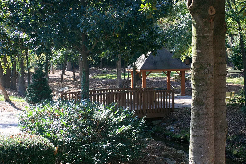
Fuquay Mineral Spring is a wooded site of about 1.24 acres at Main and West Spring Streets in Fuquay-Varina, North Carolina. A wooden gazebo with a concrete base covers the spring, and the year 1901 is carved on one of its posts. Water flows through a pipe into a concrete basin beside Neal's Creek. An open-sided pavilion, standing by 1908, was removed by 1943, and its site may offer archaeological potential. Local tradition says the Fuquay family discovered the spring in the 1850s, and a company formed in 1860 to develop it as a health resort. Between 1900 and 1930 thousands of visitors came for water believed to treat kidney and intestinal ailments, especially during Easter Monday and July 4th celebrations served by excursion trains. Boarding houses and hotels nearby supported the local economy. W. H. Aiken, a tobacco warehouse builder and mayor, later bottled and sold the water. Automobiles and seaside resorts eventually reduced the spring's popularity.
Significance in brief: The spring was a focal point for the town and region from its discovery in the 1850s, and drew thousands of visitors between 1900 and 1930 to drink its mineral water. It is argued to represent one of the few health resorts still operating in North Carolina in the early twentieth century. It is also tied to the early development of the town then known as Fuquay Springs.
Machine-generated summary. This summary was generated by a language model from the official nomination document and has not been reviewed line by line by an editor. It may contain errors. Check the source document before relying on any detail. Source: nomination document (PDF) · National Archives catalog entry. NRHP reference 86003457, listed December 4, 1986. Summary generated October 2026 (model claude-sonnet-5-5, prompt v1.0-2026-10-29, confidence high).
Key facts
| Address | NE corner of Main and W. Spring Sts., Fuquay-Varina |
|---|---|
| County | Wake County |
| Listed | December 4, 1986 |
| Reference number | 86003457 |
| Resource type | Site |
| Period of significance | 1900-1930 |
| Criteria |
|
| Areas of significance | Social History |
| Level of significance | Local |
| Status (as stated in the nomination) | The gazebo still covers the spring, which flows freely and is available to the public without charge; the pavilion was demolished by 1943. The owner's 1940s house is the only other structure on the property. |
| Acreage | 1.2 |
| Coordinates | 35.58004, -78.80048 (NPS GIS) |
What listing means for this property
Sites (archaeological sites, battlefields, landscapes) are often listed with a restricted address to protect them from looting or disturbance. Listing is honorary for private owners; federal undertakings on or near the site go through Section 106 review, and state laws may protect burials and artefacts regardless of listing.
General information, not legal or tax advice. Rules change; confirm with your State Historic Preservation Office or a qualified adviser.
Sources and further reading
- National Park Service, National Register of Historic Places database (snapshot May 2026), reference 86003457.
- Nomination form (PDF, National Archives) — catalog entry
- Wikipedia article (used for cross-checking only; text not reproduced here)
- Wikidata Q20164624
- This listing as JSON
Last updated October 2026. Found an error? See the editorial policy for how to report it.