Crabtree Creek Recreational Demonstration Area
Also known as: Umstead State Park

Why it's listed
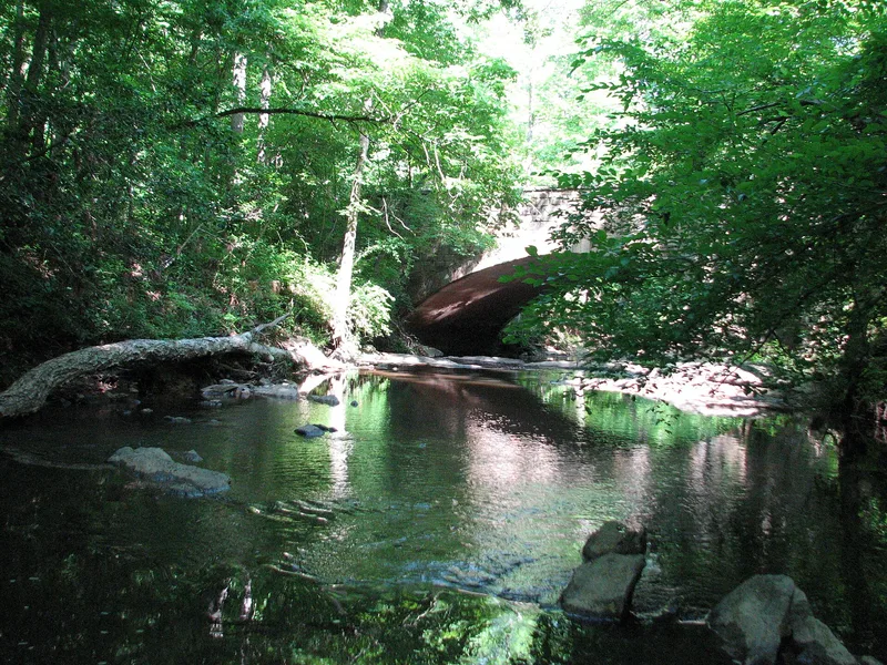
Crabtree Creek Recreational Demonstration Area is a roughly 4,900-acre park district in Raleigh, North Carolina, now known as William B. Umstead State Park. The Civilian Conservation Corps built it between 1936 and 1941 on worn-out farmland, following a 1940 master plan. It includes four group camps with ninety-two cabins and four lodges, two picnic areas with stone fountains and fireplaces, two stone-veneered bridges, more than thirty miles of trails, and two lakes created by damming Sycamore and Reedy creeks. Buildings follow the rustic style described in the National Park Service pattern book Park and Recreation Structures, with frame construction, stone chimneys and rough-sawn wood siding. Reforestation, check dams and firebreaks record the soil and forest reclamation work. The federal government sold the park to North Carolina in 1943. It is significant as an example of New Deal public works, rustic architecture, landscape design, recreation and conservation, and its camps still serve children's groups today.
Significance in brief: It is presented as a locally important example of a Depression-era public works project that turned exhausted farmland into an outdoor recreational park. It is significant for its NPS rustic architecture, landscape architecture, recreation, conservation and government associations, and it reflects the national movement to create public parks during the Progressive and New Deal eras.
Machine-generated summary. This summary was generated by a language model from the official nomination document and has not been reviewed line by line by an editor. It may contain errors. Check the source document before relying on any detail. Source: nomination document (PDF) · National Archives catalog entry. NRHP reference 95000783, listed June 30, 1995. Summary generated October 2026 (model claude-sonnet-5-5, prompt v1.0-2026-10-29, confidence medium).
Key facts
| Address | Roughly bounded by I-40, US 70 and the Raleigh--Durham Airport, Raleigh |
|---|---|
| County | Wake County |
| Listed | June 30, 1995 |
| Reference number | 95000783 |
| Resource type | District |
| Period of significance | 1933-1943 |
| Architect / builder | Marks, J.R. - landscape architect; Stout, J.D. - landscape designer; Derrick, G.R. - architectural designer; Johnson, F.J. - draftsman; built by the Civilian Conservation Corps |
| Architectural style | Other: NPS Rustic |
| Criteria |
|
| Areas of significance | Architecture, Landscape Architecture, Entertainment/Recreation, Politics/Government, Conservation |
| Level of significance | Local |
| Status (as stated in the nomination) | Group camps and day-use areas remain largely unaltered and overnight camping by children's groups continues; one lodge in Camp Lapihio is closed because of systems failure. |
| Acreage | 4912.2 |
| Coordinates | 35.85984, -78.75357 (NPS GIS) |
What listing means for this property
This is a historic district. Buildings within its boundary are either contributing (they add to the district's significance) or non-contributing. Owners of contributing income-producing buildings can claim the 20% federal rehabilitation tax credit; homeowners should look at state credits. National Register districts impose no design review by themselves; a local historic district ordinance, if one exists, does (the difference explained).
General information, not legal or tax advice. Rules change; confirm with your State Historic Preservation Office or a qualified adviser.
Sources and further reading
- National Park Service, National Register of Historic Places database (snapshot May 2026), reference 95000783.
- Nomination form (PDF, National Archives) — catalog entry
- Wikidata Q99206790
- This listing as JSON
Last updated October 2026. Found an error? See the editorial policy for how to report it.