Newland Road Site
Also known as: The Nine Foot Brick Road
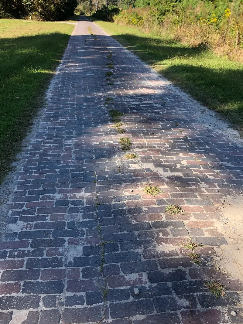

Why it's listed
Two surviving stretches of a brick highway lie east of U.S. 17 near Morgan's Corner, north of Elizabeth City. Known as the Newland Road or Nine Foot Brick Road, it was begun by the Pasquotank Highway Commission around 1920 to link Elizabeth City with South Mills and, beyond, Norfolk. The state took over the project in 1921 and required a cement and mortar base for later construction, though the first five miles had a sand and dirt base. The route followed much older roads, and excavation of a third section found bricks laid on mortar and grey clay fill, with a possible earlier cinder road beneath. When U.S. 17 replaced the road between 1930 and 1936, most bricks were removed. The remnants are valued as evidence of how a swampy coastal county sought safe, reliable motor travel, and as a source of data on brick road construction. Farming and road building have removed much of the original roadway.
Significance in brief: The road typifies early twentieth-century efforts to build hard-surfaced highways across marshy coastal terrain, first under county sponsorship and then under the State Highway Commission. It illustrates a distinctive brick construction method suited to wetlands. Excavation of one section also yielded data on construction techniques and the possible re-use of older roadbeds.
Machine-generated summary. This summary was generated by a language model from the official nomination document and has not been reviewed line by line by an editor. It may contain errors. Check the source document before relying on any detail. Source: nomination document (PDF) · National Archives catalog entry. NRHP reference 83001901, listed April 14, 1983. Summary generated October 2026 (model claude-sonnet-5-5, prompt v1.0-2026-10-29, confidence high).
Key facts
| Address | U.S. 17, Morgan's Corner |
|---|---|
| County | Pasquotank County |
| Listed | April 14, 1983 |
| Reference number | 83001901 |
| Resource type | Site |
| Period of significance | 1922 |
| Architect / builder | Pasquotank Highway Commission; Chief Engineer T.L. Higgs; local supplier apparently Lambert Brothers, Inc., of Elizabeth City |
| Criteria |
|
| Areas of significance | Commerce, Historic - Non-Aboriginal, Engineering, Transportation, Politics/Government |
| Level of significance | Local |
| Status (as stated in the nomination) | Two remnant sections survive; some are used as driveways or access roads by local residents, others have deteriorated. Agricultural equipment crossing the bricks is a current threat. Condition is marked good and altered. |
| Acreage | 1.1 |
| Coordinates | 36.37474, -76.29419 (NPS GIS) |
What listing means for this property
Sites (archaeological sites, battlefields, landscapes) are often listed with a restricted address to protect them from looting or disturbance. Listing is honorary for private owners; federal undertakings on or near the site go through Section 106 review, and state laws may protect burials and artefacts regardless of listing.
General information, not legal or tax advice. Rules change; confirm with your State Historic Preservation Office or a qualified adviser.
Sources and further reading
- National Park Service, National Register of Historic Places database (snapshot May 2026), reference 83001901.
- Nomination form (PDF, National Archives) — catalog entry
- Wikipedia article (used for cross-checking only; text not reproduced here)
- Wikidata Q19987302
- This listing as JSON
Last updated October 2026. Found an error? See the editorial policy for how to report it.