Bethania Historic District (Boundary Increase)
Also known as: See Also:Bethania Historic District

The pin is a point inside the NPS boundary polygon, not a surveyed location.
Why it's listed
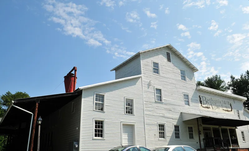
Bethania was founded in 1759 as the first planned town in the Moravians' Wachovia Tract, on a 2,500-acre Town Lot surveyed by Philip Christian Gottlieb Reuter. This amendment enlarges an earlier district that protected only the early houses, church and graveyard. The added area, nearly 500 acres, takes in the surrounding working landscape: fertile bottomlands along Muddy Creek, orchard lots, upland fields, and a road system laid out in the eighteenth century. It also includes the stone and timber remains of the 1784 Bethania Grist Mill, with its dam, race and cellar holes. Late nineteenth and early twentieth century houses, including Bungalow, Queen Anne and Colonial Revival examples, reflect continued occupation by descendants of early residents. The expansion counts 45 contributing and 76 noncontributing buildings, six contributing sites and nine contributing structures. Its argument is that the village and its farmland, roads and creeks together preserve the original Moravian town plan.
Significance in brief: The 1975 listing covered only the early residential core, which the amendment says leaves out the integral landscape systems, the significant black community and late nineteenth and early twentieth century architecture. The expansion argues that the Bottom Lots, Orchard Lots, Upland Fields, historic roads and mill ruins form a rural landscape that must be understood as a whole. The district is described as appearing much as it did when Bethania was laid out in 1759.
Machine-generated summary. This summary was generated by a language model from the official nomination document and has not been reviewed line by line by an editor. It may contain errors. Check the source document before relying on any detail. Source: nomination document (PDF) · National Archives catalog entry. NRHP reference 91000346, listed March 25, 1991. Summary generated October 2026 (model claude-sonnet-5-5, prompt v1.0-2026-10-29, confidence medium).
Key facts
| Address | Roughly, area outside present district W and N along Muddy Cr., S to Reynolda Rd. and E along Walker Rd., Bethania |
|---|---|
| County | Forsyth County |
| Listed | March 25, 1991 |
| Reference number | 91000346 |
| Resource type | District |
| Architect / builder | Philip Christian Gottlieb Reuter laid out the Town Lot (plan implemented 1759) |
| Architectural style | 19th/20th C. basic house types; Bungalow/Craftsman; Cape Cod; Queen Anne; Colonial Revival |
| Areas of significance | Industry, Community Planning and Development, Agriculture, Exploration/Settlement |
| Level of significance | State |
| Status (as stated in the nomination) | Much of the landscape remains in agricultural use (crops, pasture, hay, woodlots), with houses along the historic roads; the 1784 grist mill survives as ruins. |
| Acreage | 450 |
| Coordinates | 36.19140, -80.33659 (NPS GIS) |
What listing means for this property
This is a historic district. Buildings within its boundary are either contributing (they add to the district's significance) or non-contributing. Owners of contributing income-producing buildings can claim the 20% federal rehabilitation tax credit; homeowners should look at state credits. National Register districts impose no design review by themselves; a local historic district ordinance, if one exists, does (the difference explained).
General information, not legal or tax advice. Rules change; confirm with your State Historic Preservation Office or a qualified adviser.
Sources and further reading
- National Park Service, National Register of Historic Places database (snapshot May 2026), reference 91000346.
- Nomination form (PDF, National Archives) — catalog entry
- Wikipedia article (used for cross-checking only; text not reproduced here)
- Wikidata Q14707876
- This listing as JSON
Last updated October 2026. Found an error? See the editorial policy for how to report it.