New Bern Battlefield Site

Why it's listed
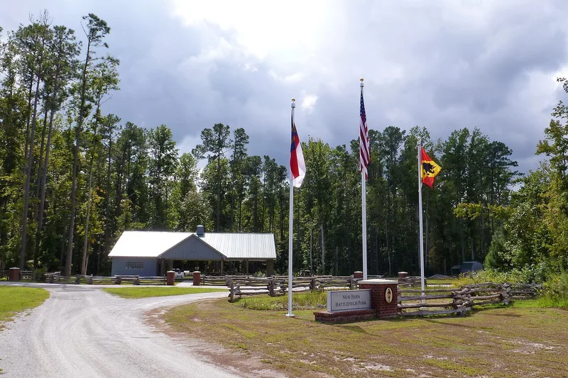
Along US 70 southeast of New Bern, two surviving pieces of a Confederate defensive line mark the ground where the Battle of New Bern was fought on March 14, 1862. East of the highway, about 1,500 feet of infantry trench remains in woods between a fairgrounds and a 1960s subdivision. West of the highway, a 98-acre tract holds redans along a ridge above Bullen's Branch, an earthwork trench near the railroad, and the remains of Wood's Brickyard. The brickyard was the weak point in the line, held by inexperienced militia, and Union troops broke through there before noon. The fight formed part of Burnside's 1862 North Carolina Campaign, the first major Union amphibious operation of the war. Victory gave Union forces a port and rail center they kept to the war's end. Development has fragmented the battlefield, but the remaining earthworks and terrain still show how the defenders were positioned and why the line failed.
Significance in brief: The Battle of New Bern was a key engagement in Burnside's 1862 North Carolina Campaign, the first major Union amphibious operation of the war. The Union victory gave the army a port and rail center it held for the rest of the war. The site is nominated under Criterion A for statewide significance in military history, and the surviving earthworks show how the battle unfolded.
Machine-generated summary. This summary was generated by a language model from the official nomination document and has not been reviewed line by line by an editor. It may contain errors. Check the source document before relying on any detail. Source: nomination document (PDF) · National Archives catalog entry. NRHP reference 01001129, listed October 19, 2001. Summary generated October 2026 (model claude-sonnet-5-5, prompt v1.0-2026-10-29, confidence medium).
Key facts
| Address | US 70 E., approx. 4.5 mi. SE of New Bern, New Bern |
|---|---|
| County | Craven County |
| Listed | October 19, 2001 |
| Reference number | 01001129 |
| Resource type | Site |
| Period of significance | March 14, 1862 |
| Criteria |
|
| Areas of significance | Military |
| Level of significance | State |
| Status (as stated in the nomination) | Fragmented by commercial and residential development; two discontiguous areas retain integrity, and the earthworks lie in wooded, undeveloped tracts. |
| Coordinates | 35.04502, -77.01781 (NPS GIS) |
What listing means for this property
Sites (archaeological sites, battlefields, landscapes) are often listed with a restricted address to protect them from looting or disturbance. Listing is honorary for private owners; federal undertakings on or near the site go through Section 106 review, and state laws may protect burials and artefacts regardless of listing.
General information, not legal or tax advice. Rules change; confirm with your State Historic Preservation Office or a qualified adviser.
Sources and further reading
- National Park Service, National Register of Historic Places database (snapshot May 2026), reference 01001129.
- Nomination form (PDF, National Archives) — catalog entry
- Wikipedia article (used for cross-checking only; text not reproduced here)
- Wikidata Q18154964
- This listing as JSON
Last updated October 2026. Found an error? See the editorial policy for how to report it.