Letchworth State Park
Also known as: Glen Iris; Letchworth Park

Why it's listed
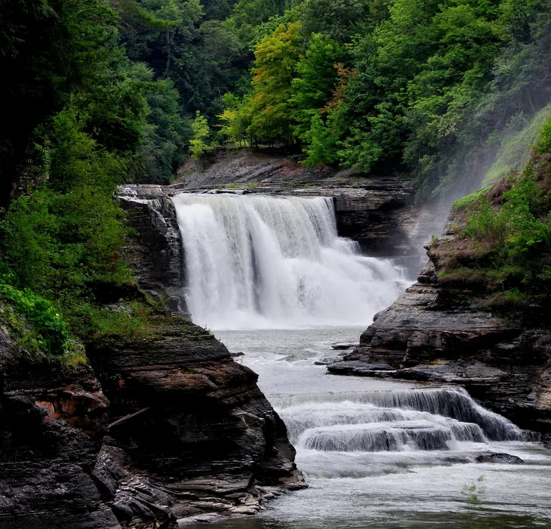
Letchworth State Park occupies about 14,345 acres along a 22-mile section of the Genesee River between Portageville and Mt. Morris, a gorge often called the "Grand Canyon of the East." The river has cut narrow, winding bedrock canyons at both ends, with three major waterfalls in the upper canyon and a flood-control dam at the Mt. Morris end. Most developed land and most historic buildings lie on the west side of the river, near the falls. The district includes natural features, archaeological sites, industrial and railroad remains, canal-related resources, designed landscapes and recreational facilities. It also holds features of the William Pryor Letchworth estate. Letchworth gave his land to the State of New York and the American Scenic and Historic Preservation Society after a hydro-electric dam was proposed that threatened the falls. Two eras of park development followed, under that society and later the New York State Council of Parks. Over one million people visit each year.
Significance in brief: The nomination presents the park as rich in natural, archaeological, Native American, early settlement, transportation and recreational resources. It is tied to the William Pryor Letchworth estate and to two eras of park development under the American Scenic and Historic Preservation Society and the New York State Council of Parks. The form recommends significance at the national and statewide levels.
Machine-generated summary. This summary was generated by a language model from the official nomination document and has not been reviewed line by line by an editor. It may contain errors. Check the source document before relying on any detail. Source: nomination document (PDF) · National Archives catalog entry. NRHP reference 03000718, listed November 4, 2005. Summary generated October 2026 (model claude-sonnet-5-5, prompt v1.0-2026-10-29, confidence medium).
Key facts
| Address | Genesee River Gorge Bet. Portageville and Mt. Morris, Genesse Falls |
|---|---|
| County | Wyoming County |
| Listed | November 4, 2005 |
| Reference number | 03000718 |
| Resource type | District |
| Architectural style | Mid-19th Century Greek Revival and Exotic Revival; Late Victorian Italianate; Colonial Revival; Bungalow/Craftsman; Naturalistic |
| Areas of significance | Agriculture, Architecture, Art, Conservation, Historic - Aboriginal, Engineering, Entertainment/Recreation, Exploration/Settlement, Landscape Architecture, Military |
| Level of significance | National, State, Local |
| Status (as stated in the nomination) | Operates as a state park; the form states it draws over one million visitors each year. |
| Acreage | 14345 |
| Coordinates | 42.58587, -78.04248 (NPS GIS) |
What listing means for this property
This is a historic district. Buildings within its boundary are either contributing (they add to the district's significance) or non-contributing. Owners of contributing income-producing buildings can claim the 20% federal rehabilitation tax credit; homeowners should look at state credits. National Register districts impose no design review by themselves; a local historic district ordinance, if one exists, does (the difference explained).
General information, not legal or tax advice. Rules change; confirm with your State Historic Preservation Office or a qualified adviser.
Sources and further reading
- National Park Service, National Register of Historic Places database (snapshot May 2026), reference 03000718.
- Nomination form (PDF, National Archives) — catalog entry
- Wikipedia article (used for cross-checking only; text not reproduced here)
- Wikidata Q1303662
- This listing as JSON
Last updated October 2026. Found an error? See the editorial policy for how to report it.