Revolutionary War Cemetery
Also known as: Old Salem Burying Ground

Why it's listed
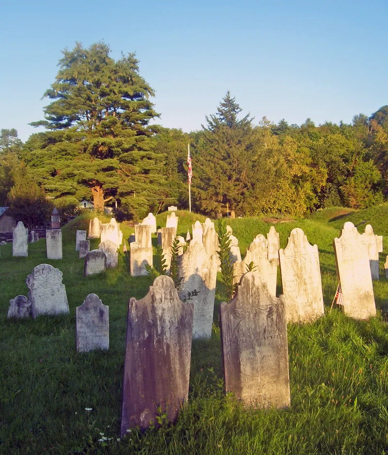
Founded around 1767, this burial ground on Archibald Street in Salem, New York, is the village's oldest cemetery. It covers 2.6 acres and is surrounded by a slate wall dating to about 1870, with a slate stepping stile and wrought iron gates. More than 1,000 burials are known, with 1,098 gravestones counted so far. They include the graves of early settlers and 105 Revolutionary War soldiers, the most in Washington County, along with soldiers of the War of 1812 and the French and Indian War. The cemetery is notable for its carved marble tablet stones, 36 of them attributed to Zerubbabel Collins, and for ten sod-covered slate family vaults built in a Roman arch style. A marble obelisk placed in 1933 honors the Revolutionary War soldiers buried here. The site keeps its original size, setting and funerary art largely intact, which is the basis for its recognition for settlement, community development, funerary art and architecture.
Significance in brief: It is the oldest cemetery in Salem and holds the graves of the town's earliest settlers, including 105 Revolutionary War soldiers, the largest number in the county. Its gravestones and slate family vaults are fine examples of 18th- and 19th-century funerary art, including 36 stones attributed to carver Zerubbabel Collins. The cemetery retains a high level of integrity in its size, setting, features and carved stones.
Machine-generated summary. This summary was generated by a language model from the official nomination document and has not been reviewed line by line by an editor. It may contain errors. Check the source document before relying on any detail. Source: nomination document (PDF) · National Archives catalog entry. NRHP reference 04000822, listed August 11, 2004. Summary generated October 2026 (model claude-sonnet-5-5, prompt v1.0-2026-10-29, confidence high).
Key facts
| Address | 9 Archibald St., Salem |
|---|---|
| County | Washington County |
| Listed | August 11, 2004 |
| Reference number | 04000822 |
| Resource type | Site |
| Period of significance | 1767-1933 |
| Criteria |
|
| Areas of significance | Community Planning and Development, Exploration/Settlement, Art, Architecture |
| Level of significance | Local |
| Status (as stated in the nomination) | Still used as a cemetery; the last burial was in 1923 and a survey of gravestones is ongoing. |
| Acreage | 2.6 |
| Coordinates | 43.16717, -73.32924 (NPS GIS) |
What listing means for this property
Sites (archaeological sites, battlefields, landscapes) are often listed with a restricted address to protect them from looting or disturbance. Listing is honorary for private owners; federal undertakings on or near the site go through Section 106 review, and state laws may protect burials and artefacts regardless of listing.
General information, not legal or tax advice. Rules change; confirm with your State Historic Preservation Office or a qualified adviser.
Sources and further reading
- National Park Service, National Register of Historic Places database (snapshot May 2026), reference 04000822.
- Nomination form (PDF, National Archives) — catalog entry
- Wikipedia article (used for cross-checking only; text not reproduced here)
- Wikidata Q543143
- This listing as JSON
Last updated October 2026. Found an error? See the editorial policy for how to report it.