Miller, William, Farm Historic District (Boundary Increase)
Also known as: William Miller Chapel Boundary Increase; See Also:Miller, Wil

Why it's listed
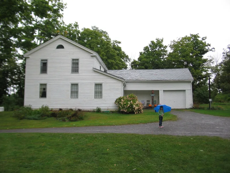
This farm district in Low Hampton, Washington County, New York, covers about 25 acres that once belonged to a 146-acre parcel assembled by William Miller in 1814. It includes his two-story frame house, completed in 1815 and later updated by his son with a Greek Revival doorway and end flues. A complex of seven farm buildings and structures, a limestone quarry and kiln, a maple grove, stone and wire fences, and traces of an orchard record farm life across several generations. Miller also built the chapel here in 1848, and the limestone outcrop called Ascension Rock is where he and his followers waited for the expected end of the world in 1844. The district was recognized as the property most closely tied to Miller, a Baptist preacher shaped by the revival movements of upstate New York. It adds the farm to the chapel and Ascension Rock, which were listed earlier, in 1975. His boyhood home and family cemetery lie nearby but are outside the boundary.
Significance in brief: The farm is the resource most strongly associated with William Miller, the religious leader whose followers awaited the apocalypse in 1844 at Ascension Rock. The nomination places him within the early nineteenth-century revival movements of upstate New York. The boundary increase adds the farm to the previously listed chapel and Ascension Rock.
Machine-generated summary. This summary was generated by a language model from the official nomination document and has not been reviewed line by line by an editor. It may contain errors. Check the source document before relying on any detail. Source: nomination document (PDF) · National Archives catalog entry. NRHP reference 94000256, listed April 4, 1994. Summary generated October 2026 (model claude-sonnet-5-5, prompt v1.0-2026-10-29, confidence medium).
Key facts
| Address | Co. Rt. 11 W of US 4, Hampton |
|---|---|
| County | Washington County |
| Listed | April 4, 1994 |
| Reference number | 94000256 |
| Resource type | District |
| Architect / builder | William Miller (built house 1815 and chapel 1848); son John Miller (1850s alterations) |
| Architectural style | Federal; Greek Revival; No Style |
| Areas of significance | Religion, Social History, Architecture |
| Level of significance | National |
| Status (as stated in the nomination) | The house has had restoration work underway, with a restoration plan developed; the chapel and farm are currently used as a museum and religious site, and the farm buildings are described as remaining. |
| Acreage | 25 |
| Coordinates | 43.59534, -73.31183 (NPS GIS) |
What listing means for this property
This is a historic district. Buildings within its boundary are either contributing (they add to the district's significance) or non-contributing. Owners of contributing income-producing buildings can claim the 20% federal rehabilitation tax credit; homeowners should look at state credits. National Register districts impose no design review by themselves; a local historic district ordinance, if one exists, does (the difference explained).
General information, not legal or tax advice. Rules change; confirm with your State Historic Preservation Office or a qualified adviser.
Sources and further reading
- National Park Service, National Register of Historic Places database (snapshot May 2026), reference 94000256.
- Nomination form (PDF, National Archives) — catalog entry
- Wikipedia article (used for cross-checking only; text not reproduced here)
- Wikidata Q14707796
- This listing as JSON
Last updated October 2026. Found an error? See the editorial policy for how to report it.