Sharp Burial Ground

Why it's listed
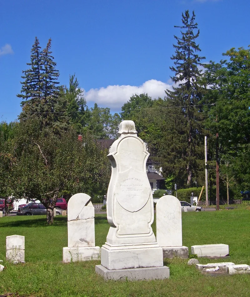
Sharp Burial Ground is a cemetery of about two acres on the east side of Albany Avenue in Kingston, New York. Surveyor Edward O'Neil mapped it on July 20, 1832, as a grid of 210 plots, with smaller lots on the south side and larger ones across the northern two-thirds. Lots along Albany Avenue were reserved for Baptist, Episcopal, Dutch and Methodist parsonages. Records show burials began as early as 1810, and the last recorded burials took place in the 1870s. Cemetery records list 186 burials. Such surveyed grid cemeteries replaced crowded churchyards and rural family plots as villages grew. Only a few dozen markers survive today. They include O'Neil's own marble monument, with a carved wreath, and Abraham Hasbrouck's tall marble obelisk. Willow and urn designs are common, including one on a child's marker. Many remains were probably moved when larger cemeteries opened in Kingston. The Friends of Historic Kingston restored the site in 1995 and added an iron fence and gate.
Significance in brief: It is a surviving second-generation burial ground in Kingston, planned on a surveyed grid as villages outgrew churchyards and family burial sites. It also holds a collection of early to mid-nineteenth century funerary art, including willow-and-urn motifs and the monuments of Edward O'Neil and Abraham Hasbrouck.
Machine-generated summary. This summary was generated by a language model from the official nomination document and has not been reviewed line by line by an editor. It may contain errors. Check the source document before relying on any detail. Source: nomination document (PDF) · National Archives catalog entry. NRHP reference 02001320, listed November 15, 2002. Summary generated October 2026 (model claude-sonnet-5-5, prompt v1.0-2026-10-29, confidence high).
Key facts
| Address | Albany Ave., Kingston |
|---|---|
| County | Ulster County |
| Listed | November 15, 2002 |
| Reference number | 02001320 |
| Resource type | Site |
| Period of significance | c.1832-c.1920 |
| Criteria |
|
| Areas of significance | Art, Community Planning and Development |
| Level of significance | Local |
| Status (as stated in the nomination) | Restored in 1995 by the Friends of Historic Kingston, which cleaned the grounds and added an iron fence and gate along Albany Avenue. The burial ground is no longer used for burials and is cared for by the city. |
| Acreage | 1.6 |
| Coordinates | 41.93846, -74.00272 (NPS GIS) |
What listing means for this property
Sites (archaeological sites, battlefields, landscapes) are often listed with a restricted address to protect them from looting or disturbance. Listing is honorary for private owners; federal undertakings on or near the site go through Section 106 review, and state laws may protect burials and artefacts regardless of listing.
General information, not legal or tax advice. Rules change; confirm with your State Historic Preservation Office or a qualified adviser.
Sources and further reading
- National Park Service, National Register of Historic Places database (snapshot May 2026), reference 02001320.
- Nomination form (PDF, National Archives) — catalog entry
- Wikipedia article (used for cross-checking only; text not reproduced here)
- Wikidata Q1417213
- This listing as JSON
Last updated October 2026. Found an error? See the editorial policy for how to report it.