Sunday Rock

Why it's listed
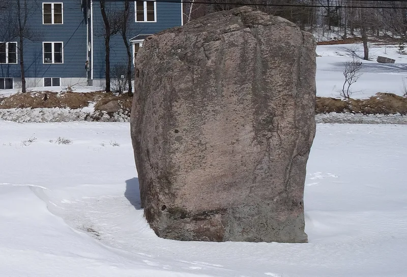
Sunday Rock is a massive glacial boulder weighing 64,000 pounds and standing 11 feet tall beside NY 56, just outside South Colton in St. Lawrence County. Deposited by a receding glacier, it served Native Americans as a travelers' landmark and later became a symbolic boundary between settled farmland and the Adirondack wilderness. Local lore, tied especially to lumberjacks and river drivers, held that there was "no Sunday" beyond the rock, and the name was well established by the 1860s. Highway construction threatened the boulder twice. In 1925 public outcry stopped plans to dynamite it, and it was moved 12 feet to the roadside. In 1965 a widening project again threatened it, and it was moved across the road onto donated town land. Two concrete monuments with plaques mark these moves. The boulder is listed for its role in local preservation efforts and its place in regional folklore and identity.
Significance in brief: The nomination argues it is significant under Criterion A in Conservation, for local efforts in 1925 and 1965 that saved it from destruction during highway projects. It is also significant in Social History as a landmark and folklore symbol marking a traveler's passage from "the woods to the world."
Machine-generated summary. This summary was generated by a language model from the official nomination document and has not been reviewed line by line by an editor. It may contain errors. Check the source document before relying on any detail. Source: nomination document (PDF) · National Archives catalog entry. NRHP reference 10000990, listed December 7, 2010. Summary generated October 2026 (model claude-sonnet-5-5, prompt v1.0-2026-10-29, confidence high).
Key facts
| Address | NY 56, South Colton |
|---|---|
| County | St. Lawrence County |
| Listed | December 7, 2010 |
| Reference number | 10000990 |
| Resource type | Object |
| Period of significance | 1925-1965 |
| Criteria |
|
| Areas of significance | Conservation |
| Level of significance | Local |
| Status (as stated in the nomination) | Sits on a grassy island in a small roadside park with picnic tables, benches and a parking area; it has been moved twice, remaining within 12 feet of its original location. |
| Acreage | 0.3 |
| Coordinates | 44.51175, -74.89376 (NPS GIS) |
What listing means for this property
National Register listing is honorary: it recognises significance and does not restrict what a private owner may do without federal money or permits. It unlocks the 20% federal rehabilitation tax credit for income-producing buildings, state credits in many states, and Section 106 review when federal agencies are involved. See what listing means in practice.
General information, not legal or tax advice. Rules change; confirm with your State Historic Preservation Office or a qualified adviser.
Sources and further reading
- National Park Service, National Register of Historic Places database (snapshot May 2026), reference 10000990.
- Nomination form (PDF, National Archives) — catalog entry
- Wikipedia article (used for cross-checking only; text not reproduced here)
- Wikidata Q7639543
- This listing as JSON
Last updated October 2026. Found an error? See the editorial policy for how to report it.