South Worcester Historic District

Why it's listed
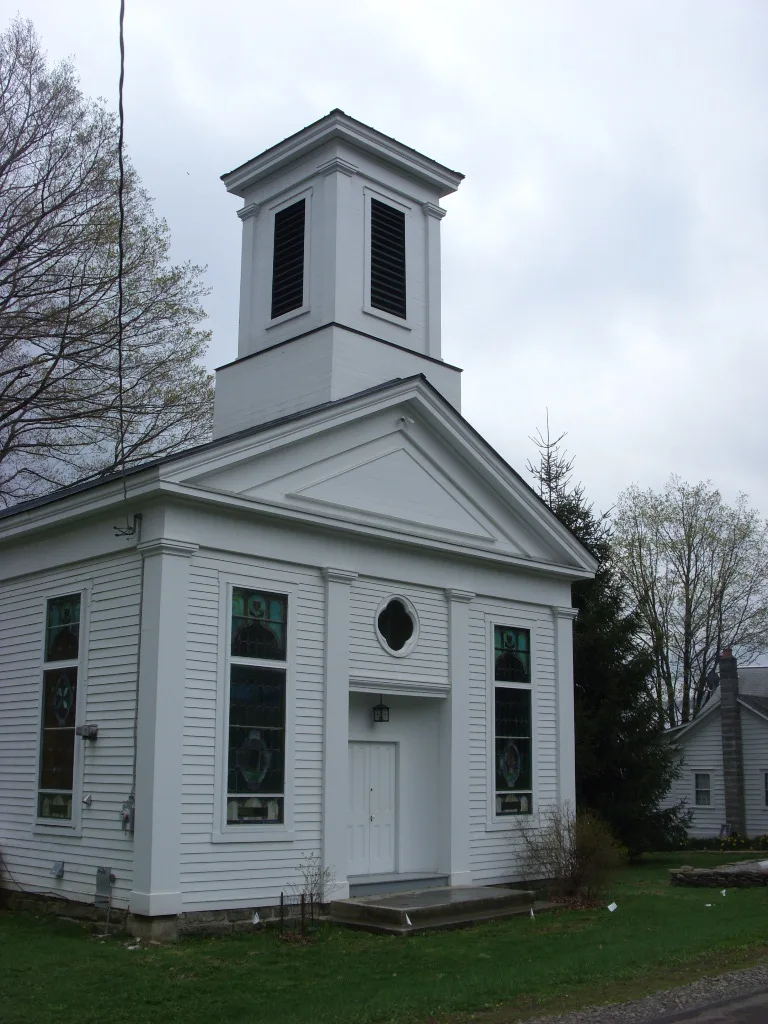
South Worcester is a small farming hamlet strung along Otsego County Route 40 for about a mile in the Charlotte River valley, in the northwestern foothills of the Catskills. The district holds 41 buildings, mostly wood-frame houses and outbuildings built between about 1810 and 1942, along with two historic cemeteries, an active dairy farm and surrounding fields and wooded hillsides. Federal buildings include a ca. 1830 law office and a ca. 1840 pharmacy shop. Greek Revival is seen in two mid-nineteenth-century churches and several farmhouses, and Italianate in a few residences. A rare saltbox-shaped blacksmith shop and a three-story bank barn illustrate the support buildings of a farming community. The hamlet was listed because it is an unusually complete example of the small centers that served rural central New York, offering business, schooling, worship and social life. Population decline and isolation after 1942 discouraged new construction, so the vernacular architecture and open rural setting remain largely intact.
Significance in brief: The nomination argues the hamlet is a complete and unusually well-preserved example of a central New York farming community between 1810 and 1942. Its vernacular Federal, Greek Revival and Italianate buildings, churches, support structures and open agricultural setting remained largely unchanged because of population decline and isolation after 1942.
Machine-generated summary. This summary was generated by a language model from the official nomination document and has not been reviewed line by line by an editor. It may contain errors. Check the source document before relying on any detail. Source: nomination document (PDF) · National Archives catalog entry. NRHP reference 92001563, listed November 5, 1992. Summary generated October 2026 (model claude-sonnet-5-5, prompt v1.0-2026-10-29, confidence medium).
Key facts
| Address | Jct. of Co. Rt. 40 and Co. Rt. 39 and W along 40, South Worcester |
|---|---|
| County | Otsego County |
| Listed | November 5, 1992 |
| Reference number | 92001563 |
| Resource type | District |
| Period of significance | 1810-1942 |
| Architectural style | Early Republic/Federal; Mid-19th Century/Greek Revival; Mid-19th Century/Italianate |
| Areas of significance | Architecture |
| Level of significance | Local |
| Status (as stated in the nomination) | Mostly in use: about 20 of the 41 buildings are residences, one farm is active, and former churches and the schoolhouse have been adapted to residential or studio use. |
| Acreage | 633 |
| Coordinates | 42.51750, -74.75791 (NPS GIS) |
What listing means for this property
This is a historic district. Buildings within its boundary are either contributing (they add to the district's significance) or non-contributing. Owners of contributing income-producing buildings can claim the 20% federal rehabilitation tax credit; homeowners should look at state credits. National Register districts impose no design review by themselves; a local historic district ordinance, if one exists, does (the difference explained).
General information, not legal or tax advice. Rules change; confirm with your State Historic Preservation Office or a qualified adviser.
Sources and further reading
- National Park Service, National Register of Historic Places database (snapshot May 2026), reference 92001563.
- Nomination form (PDF, National Archives) — catalog entry
- Wikipedia article (used for cross-checking only; text not reproduced here)
- Wikidata Q7568968
- This listing as JSON
Last updated October 2026. Found an error? See the editorial policy for how to report it.