Wilder Cemetery

Why it's listed
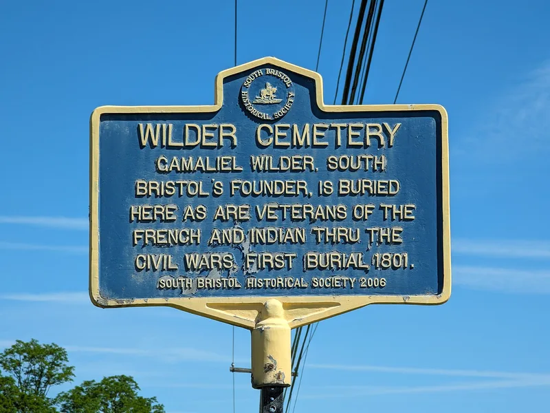
Wilder Cemetery is a one-acre burial ground on a knoll east of NY 64 in rural South Bristol, Ontario County. It holds about sixty graves dating from 1801 to 1900, most marked by simple limestone headstones grouped informally by family. The cemetery is all that remains of Mud Creek, a hamlet begun in the late eighteenth century by Gamaliel Wilder, the first settler of South Bristol, who was buried here in 1817 along with many relatives and neighbors. Veterans of the Revolutionary War, War of 1812 and Civil War are also interred. The markers show early nineteenth century funerary art, including urns, willows and winged angels. Although the cemetery was town-owned for most of its history and later became landlocked within a former farm that passed to private ownership, it remains largely intact, ringed by mature trees and shrubs. It was recognized for its association with local settlement and for the artistic quality of its gravestones, with a period of significance of 1801 to 1900.
Significance in brief: It is the sole surviving remnant of the hamlet of Mud Creek, founded by Gamaliel Wilder, and reflects South Bristol's settlement era. Its finely carved limestone markers show early nineteenth century funerary art, including urn, willow and winged angel motifs. It also holds the graves of Revolutionary War, War of 1812 and Civil War veterans.
Machine-generated summary. This summary was generated by a language model from the official nomination document and has not been reviewed line by line by an editor. It may contain errors. Check the source document before relying on any detail. Source: nomination document (PDF) · National Archives catalog entry. NRHP reference 03000130, listed March 23, 2003. Summary generated October 2026 (model claude-sonnet-5-5, prompt v1.0-2026-10-29, confidence high).
Key facts
| Address | NY 64, S. Bristol |
|---|---|
| County | Ontario County |
| Listed | March 23, 2003 |
| Reference number | 03000130 |
| Resource type | Site |
| Period of significance | 1801-1900 |
| Criteria |
|
| Areas of significance | Exploration/Settlement |
| Level of significance | Local |
| Status (as stated in the nomination) | Partially overgrown and neglected for several decades, though it retains a high degree of integrity; some stones have fallen or tilted. The last burial was in 1900. |
| Acreage | 1 |
| Coordinates | 42.73561, -77.39764 (NPS GIS) |
What listing means for this property
Sites (archaeological sites, battlefields, landscapes) are often listed with a restricted address to protect them from looting or disturbance. Listing is honorary for private owners; federal undertakings on or near the site go through Section 106 review, and state laws may protect burials and artefacts regardless of listing.
General information, not legal or tax advice. Rules change; confirm with your State Historic Preservation Office or a qualified adviser.
Sources and further reading
- National Park Service, National Register of Historic Places database (snapshot May 2026), reference 03000130.
- Nomination form (PDF, National Archives) — catalog entry
- Wikipedia article (used for cross-checking only; text not reproduced here)
- Wikidata Q8001089
- This listing as JSON
Last updated October 2026. Found an error? See the editorial policy for how to report it.