Wright Settlement Cemetery

Why it's listed
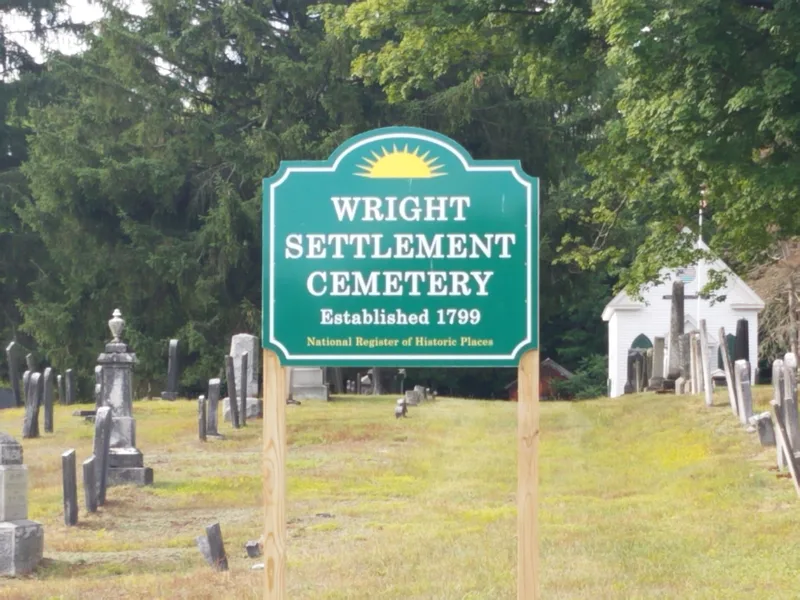
Wright Settlement Cemetery occupies 8.7 acres along Cemetery Road in the Wright Settlement area of Rome, Oneida County. The earliest dated stone is from 1806, and burials continue today. Roughly 3,000 markers range from plain uncut stones to large ornate family plots, arranged mostly by family rather than by period. A c1870 frame chapel with pointed-arch windows and a slate fish-scale roof stands on the grounds, along with a c1870 board-clad carriage house. The cemetery matters because the community around it was largely erased in 1941, when the Army Air Force took 2,500 acres for the Rome Air Depot. The burial ground is the one remaining resource with historic integrity that records the settlers, their origins, marriages and beliefs. It holds a notable group of zinc monuments made by the Monumental Bronze Company of Bridgeport, Connecticut, plus Welsh inscriptions reflecting the area's large Welsh immigrant population.
Significance in brief: The cemetery is the only surviving physical resource with historic integrity that records the settlement and development of Wright Settlement, most of which was razed in 1941 for the Rome Air Depot. Its more than 3,000 stones document family origins, ethnicity and religion, including the area's large Welsh immigrant community. It also shows changing gravestone styles and funerary art, notably an unusual number of zinc "White Bronze" monuments, and some influence of the rural cemetery movement.
Machine-generated summary. This summary was generated by a language model from the official nomination document and has not been reviewed line by line by an editor. It may contain errors. Check the source document before relying on any detail. Source: nomination document (PDF) · National Archives catalog entry. NRHP reference 12000256, listed May 8, 2012. Summary generated October 2026 (model claude-sonnet-5-5, prompt v1.0-2026-10-29, confidence medium).
Key facts
| Address | Cemetery Rd., Wright Settlement |
|---|---|
| County | Oneida County |
| Listed | May 8, 2012 |
| Reference number | 12000256 |
| Resource type | Site |
| Period of significance | 1806-1962 |
| Architect / builder | Unknown |
| Architectural style | No Style |
| Criteria |
|
| Areas of significance | Art, Exploration/Settlement, Social History |
| Level of significance | Local |
| Status (as stated in the nomination) | The cemetery is still in use for burials, except the unmarked paupers plot, and the chapel and carriage house are contributing buildings. |
| Acreage | 8.7 |
| Coordinates | 43.25109, -75.40760 (NPS GIS) |
What listing means for this property
Sites (archaeological sites, battlefields, landscapes) are often listed with a restricted address to protect them from looting or disturbance. Listing is honorary for private owners; federal undertakings on or near the site go through Section 106 review, and state laws may protect burials and artefacts regardless of listing.
General information, not legal or tax advice. Rules change; confirm with your State Historic Preservation Office or a qualified adviser.
Sources and further reading
- National Park Service, National Register of Historic Places database (snapshot May 2026), reference 12000256.
- Nomination form (PDF, National Archives) — catalog entry
- Wikipedia article (used for cross-checking only; text not reproduced here)
- Wikidata Q22026348
- This listing as JSON
Last updated October 2026. Found an error? See the editorial policy for how to report it.