Jones Beach State Park, Causeway and Parkway System

Why it's listed
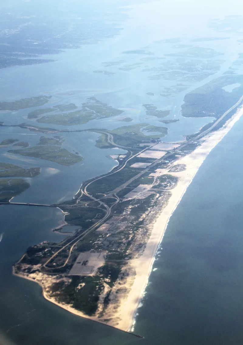
Jones Beach State Park occupies the western part of a long coastal barrier island off the south shore of Long Island, in Nassau County. Before the 1920s the island was nearly inaccessible, so causeways were central to the design. Wantagh and Meadowbrook causeways cross the bay to the mainland, Loop Parkway links the park to Long Beach, and Bay and Ocean Parkways carry traffic within the park. Engineers dredged fill from the bay to raise the island about fourteen feet and built artificial dunes before construction began. The park follows a formal Beaux-Arts plan. A 231-foot brick and sandstone water tower, completed in 1930, anchors the central traffic circle, with symmetrical bathhouses, a mall and a long boardwalk nearby. Other features include pools, golf courses, parking fields, a theater on Zach's Bay and service buildings. Development came in three phases between about 1926 and 1954. The district was listed as a key part of the Long Island State Park and Parkway System, with significance certified at the national level.
Significance in brief: The nomination presents Jones Beach State Park as the most important state park on Long Island and the centerpiece of the Long Island State Park and Parkway System developed under the Long Island State Park Commission. It combines a major engineering project that raised the island, a formal Beaux-Arts plan, and brick and sandstone buildings. The causeways and parkways are described as the earliest and most essential links for access and circulation. The form certifies significance at the national level.
Machine-generated summary. This summary was generated by a language model from the official nomination document and has not been reviewed line by line by an editor. It may contain errors. Check the source document before relying on any detail. Source: nomination document (PDF) · National Archives catalog entry. NRHP reference 05000358, listed April 28, 2005. Summary generated October 2026 (model claude-sonnet-5-5, prompt v1.0-2026-10-29, confidence medium).
Key facts
| Address | Ocean, Wantagh, Meadowbrook and Loop State Parkways, Wantagh |
|---|---|
| County | Nassau County |
| Listed | April 28, 2005 |
| Reference number | 05000358 |
| Resource type | District |
| Architectural style | No style (Beaux-Arts plan; Art Deco aesthetic in the water tower; one Colonial Revival residence) |
| Areas of significance | Entertainment/Recreation, Community Planning and Development, Architecture, Landscape Architecture |
| Level of significance | National, State |
| Status (as stated in the nomination) | Park and parkways remain in recreational and transportation use; some original buildings have been lost, replaced or altered, and a new building is being designed for the site of a lost restaurant. |
| Acreage | 10034 |
| Coordinates | 40.62955, -73.53571 (NPS GIS) |
What listing means for this property
This is a historic district. Buildings within its boundary are either contributing (they add to the district's significance) or non-contributing. Owners of contributing income-producing buildings can claim the 20% federal rehabilitation tax credit; homeowners should look at state credits. National Register districts impose no design review by themselves; a local historic district ordinance, if one exists, does (the difference explained).
General information, not legal or tax advice. Rules change; confirm with your State Historic Preservation Office or a qualified adviser.
Sources and further reading
- National Park Service, National Register of Historic Places database (snapshot May 2026), reference 05000358.
- Nomination form (PDF, National Archives) — catalog entry
- Wikipedia article (used for cross-checking only; text not reproduced here)
- Wikidata Q6275135
- This listing as JSON
Last updated October 2026. Found an error? See the editorial policy for how to report it.