Fort Plain Historic District (Additional Documentation)

Why it's listed
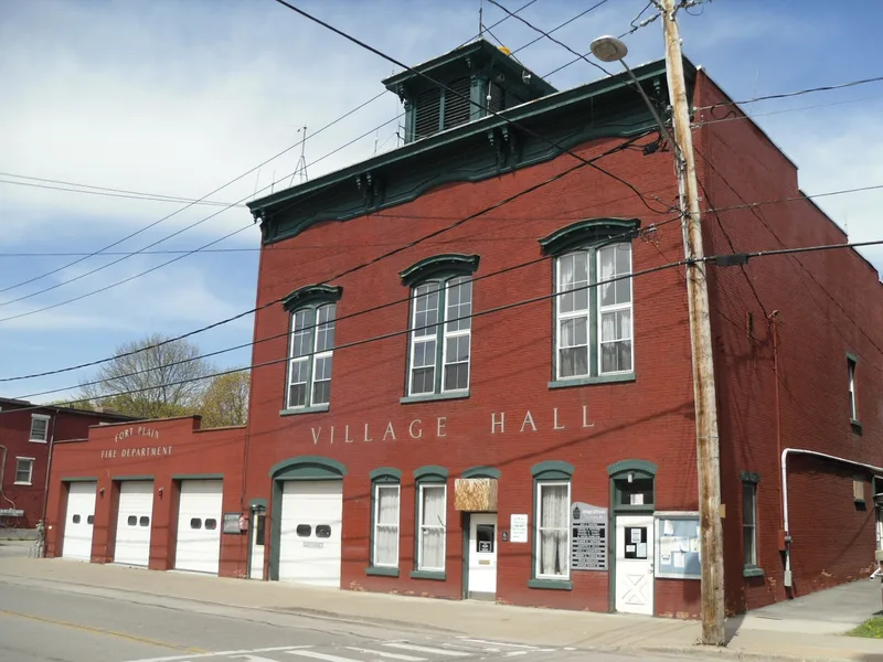
Fort Plain is a canal-era village on the Mohawk River in Montgomery County, New York, and this district takes in most of the part of it built up by about 1920. Its street plan was laid out in anticipation of the Erie Canal, set over older, long riverfront farm lots. Canal Street keeps a nearly continuous row of three-story warehouses and storefronts, while Main Street and Otsquago Creek hold the remains of water-powered mills such as the 1860 Red Mill. Steam-powered factories stand along Willett Street. Churches from the 1870s to about 1900, an 1870s Italianate village hall and a 1915 Beaux-Arts high school add civic character. Houses range from the 1786 Isaac Paris house to Queen Anne mansions on Prospect Street, showing the social range of a prosperous canal town. Local limestone foundations unify many buildings. Streetscapes still resemble their late nineteenth-century appearance, with few losses beyond the filled-in canal.
Significance in brief: The district preserves a highly intact canal-era village with commercial rows, churches, civil and industrial buildings, and houses in Federal, Greek Revival, Gothic Revival, Italianate and Queen Anne styles. It shows the people and development patterns of a prosperous nineteenth-century canal community. The form describes it as locally significant.
Machine-generated summary. This summary was generated by a language model from the official nomination document and has not been reviewed line by line by an editor. It may contain errors. Check the source document before relying on any detail. Source: nomination document (PDF) · National Archives catalog entry. NRHP reference 12000510, listed August 15, 2012. Summary generated October 2026 (model claude-sonnet-5-5, prompt v1.0-2026-10-29, confidence medium).
Key facts
| Address | Portions of Abbott, Canal, Hancock, Beck, Clyde, Douglas, Edwards, Erie, Garfield, Hancock, Henry, Herkimer, High, Main, Reid, River, Roof, State, Wagner, Webster, Willett, and Witter Sts.., Clark, Clinton, Gilbert, Silk, and Waddell Aves., Fort Plain |
|---|---|
| County | Montgomery County |
| Listed | August 15, 2012 |
| Reference number | 12000510 |
| Resource type | District |
| Architectural style | Various (Federal, Greek Revival, Gothic Revival, Italianate, Queen Anne, Beaux-Arts and others) |
| Areas of significance | Architecture, Community Planning and Development, Commerce, Transportation |
| Level of significance | Local |
| Status (as stated in the nomination) | Most of the district is described as highly intact with few intrusions; the Erie Canal itself was filled in and became State Street. |
| Acreage | 216.96 |
| Coordinates | 43.07505, -74.62673 (NPS GIS) |
What listing means for this property
This is a historic district. Buildings within its boundary are either contributing (they add to the district's significance) or non-contributing. Owners of contributing income-producing buildings can claim the 20% federal rehabilitation tax credit; homeowners should look at state credits. National Register districts impose no design review by themselves; a local historic district ordinance, if one exists, does (the difference explained).
General information, not legal or tax advice. Rules change; confirm with your State Historic Preservation Office or a qualified adviser.
Sources and further reading
- National Park Service, National Register of Historic Places database (snapshot May 2026), reference 12000510.
- Nomination form (PDF, National Archives) — catalog entry
- Wikipedia article (used for cross-checking only; text not reproduced here)
- Wikidata Q23091580
- This listing as JSON
Last updated October 2026. Found an error? See the editorial policy for how to report it.