Chenango Canal Summit Level

Why it's listed
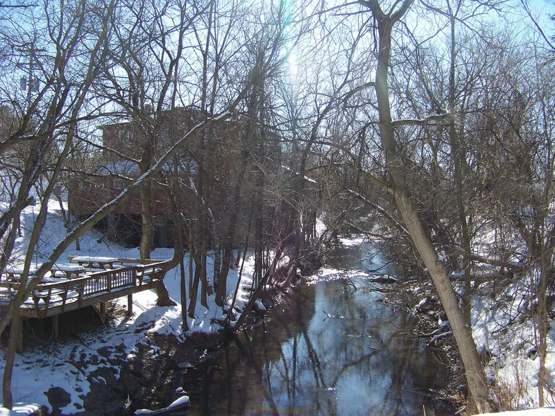
Five miles of the old Chenango Canal, its summit level near Bouckville in Madison County, New York, remain filled with water today. The state built the canal between 1834 and 1836 to link Utica on the Erie Canal with Binghamton on the Susquehanna River, a route requiring 116 locks. The summit stretch needed none, though workers blasted through 25 feet of solid rock for two miles. The canal never succeeded commercially, and railroads in the 1860s took what traffic it had. The state closed it to boats in 1878 but kept the summit as a feeder for the Enlarged Erie Canal, and later for the Erie-Barge Canal, a role it still fills. Since the Chenango was never enlarged, it preserves the dimensions and methods of the original Erie Canal, very little of which survives. Surviving features include the canal prism, the towpath, stone bridge abutments, and the remains of an aqueduct over Oriskany Creek.
Significance in brief: The nomination argues it is significant under Criterion A as an integral part of New York's early nineteenth-century canal system, and under Criterion C as an example of early canal engineering and construction. Because the Chenango was never enlarged, it preserves the scale and specifications of the original Erie Canal era. It still serves as a feeder to the Erie-Barge Canal.
Machine-generated summary. This summary was generated by a language model from the official nomination document and has not been reviewed line by line by an editor. It may contain errors. Check the source document before relying on any detail. Source: nomination document (PDF) · National Archives catalog entry. NRHP reference 05000684, listed July 6, 2005. Summary generated October 2026 (model claude-sonnet-5-5, prompt v1.0-2026-10-29, confidence high).
Key facts
| Address | Along Canal Rd., Bouckville |
|---|---|
| County | Madison County |
| Listed | July 6, 2005 |
| Reference number | 05000684 |
| Resource type | District |
| Period of significance | 1833-1954 |
| Criteria |
|
| Areas of significance | Transportation, Maritime History, Commerce |
| Level of significance | State |
| Status (as stated in the nomination) | The section remains watered and is owned and operated by the New York State Canal Corporation as a feeder for the Erie (Barge) Canal; the towpath is mostly maintained as a hiking trail. |
| Coordinates | 42.88342, -75.55025 (NPS GIS) |
What listing means for this property
This is a historic district. Buildings within its boundary are either contributing (they add to the district's significance) or non-contributing. Owners of contributing income-producing buildings can claim the 20% federal rehabilitation tax credit; homeowners should look at state credits. National Register districts impose no design review by themselves; a local historic district ordinance, if one exists, does (the difference explained).
General information, not legal or tax advice. Rules change; confirm with your State Historic Preservation Office or a qualified adviser.
Sources and further reading
- National Park Service, National Register of Historic Places database (snapshot May 2026), reference 05000684.
- Nomination form (PDF, National Archives) — catalog entry
- Wikipedia article (used for cross-checking only; text not reproduced here)
- Wikidata Q5091034
- This listing as JSON
Last updated October 2026. Found an error? See the editorial policy for how to report it.