Johnstown Colonial Cemetery

Why it's listed
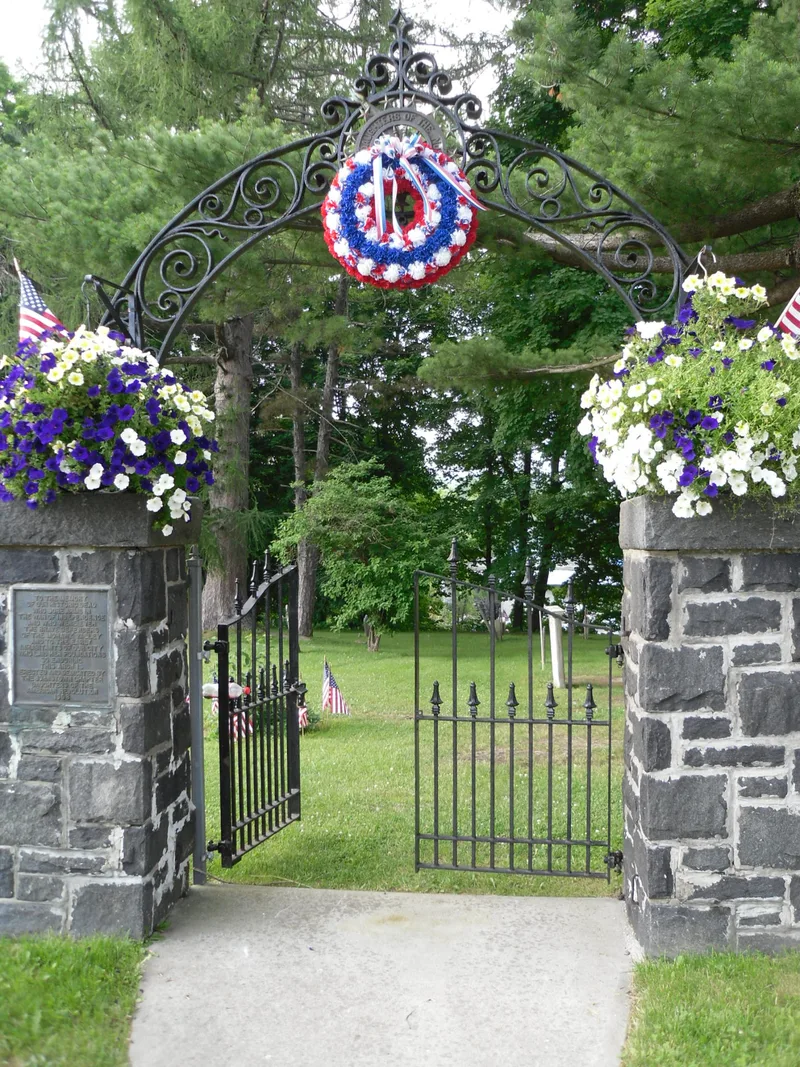
Set on level high ground in north-central Johnstown, this 1.1-acre burying ground began in 1766 as the churchyard of St. John's Episcopal Church, established by Sir William Johnson. Stone from the first church, demolished in 1771, was used for the cut limestone and fieldstone wall that encloses the site. About 150 limestone and marble markers remain, dating from the late eighteenth to the late nineteenth century. The oldest show urns, willows, drapery swags and entwined vines, while later stones are plain. Buried here are early settlers, many with Scottish surnames, at least 18 Revolutionary War veterans, and local leaders such as Major John Little and glove-industry founder Edwards Talmadge. The last recorded burial took place in 1914, the year the Daughters of the American Revolution dedicated the memorial gate arch. After a period of neglect, the town and community took up repair and upkeep in the 1990s. It was listed for its settlement history and its funerary art, along with its age, rarity and integrity.
Significance in brief: It is presented as a rare, intact burying ground tied to the earliest settlement and development of Johnstown, holding the graves of early settlers, at least 18 Revolutionary War veterans and civic leaders. Its roughly 150 gravestones show regional funerary carving and mourning motifs. The form marked Criteria A, C and D, but the Keeper's amendment deleted Criterion D as unjustified.
Machine-generated summary. This summary was generated by a language model from the official nomination document and has not been reviewed line by line by an editor. It may contain errors. Check the source document before relying on any detail. Source: nomination document (PDF) · National Archives catalog entry. NRHP reference 98000129, listed March 9, 1998. Summary generated October 2026 (model claude-sonnet-5-5, prompt v1.0-2026-10-29, confidence high).
Key facts
| Address | Jct. of W. Green and N. Market Sts., Johnstown |
|---|---|
| County | Fulton County |
| Listed | March 9, 1998 |
| Reference number | 98000129 |
| Resource type | District |
| Period of significance | ca. 1766-1914 |
| Architectural style | No style |
| Criteria |
|
| Areas of significance | Exploration/Settlement, Art |
| Level of significance | Local |
| Status (as stated in the nomination) | Still a cemetery. Fallen wall sections were repaired in 1996, and community efforts since the mid-1990s have recorded, refurbished and maintained it. |
| Acreage | 1.1 |
| Coordinates | 43.00853, -74.37273 (NPS GIS) |
What listing means for this property
This is a historic district. Buildings within its boundary are either contributing (they add to the district's significance) or non-contributing. Owners of contributing income-producing buildings can claim the 20% federal rehabilitation tax credit; homeowners should look at state credits. National Register districts impose no design review by themselves; a local historic district ordinance, if one exists, does (the difference explained).
General information, not legal or tax advice. Rules change; confirm with your State Historic Preservation Office or a qualified adviser.
Sources and further reading
- National Park Service, National Register of Historic Places database (snapshot May 2026), reference 98000129.
- Nomination form (PDF, National Archives) — catalog entry
- Wikipedia article (used for cross-checking only; text not reproduced here)
- Wikidata Q14706694
- This listing as JSON
Last updated October 2026. Found an error? See the editorial policy for how to report it.