Beer's Bridge

Why it's listed
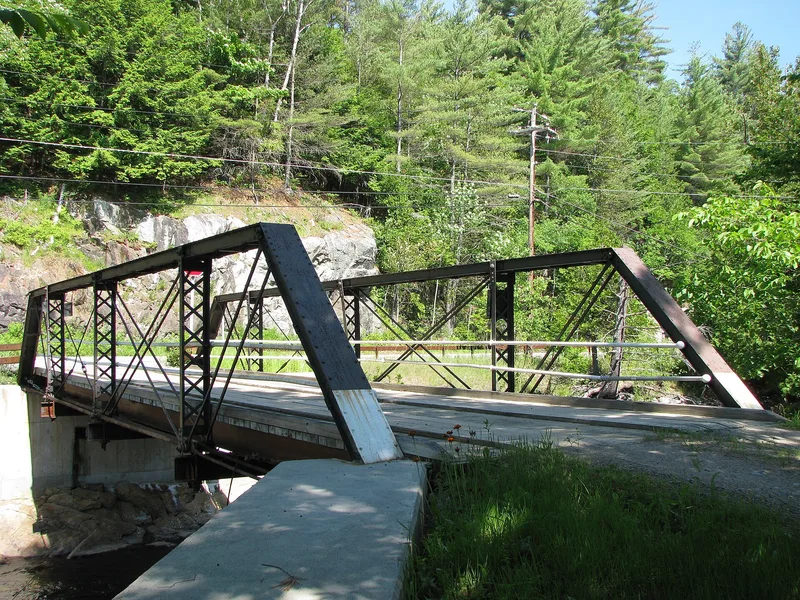
Beer's Bridge is a 53-foot, single-lane Pratt pony truss carrying a private road over the East Branch of the AuSable River, several miles upstream from Keene Valley in the Adirondacks. Built around 1900 in the town of Lewis, it became obsolete there. After a devastating flood in 1924 washed away several bridges in the town of Keene, two local men, Fedor Smith and Paul Sachs, moved it to its present site about 1925. Its pin-connected metal members, eye-bar bottom chords and diagonals, and rod counters reflect the light construction of small rural bridges of its era, and the truss follows a design patented by Thomas and Caleb Pratt in 1844. The wood deck has been replaced in kind and the floor system was reinforced with I-beams around 1993, yet most original components remain. It is recognized for its engineering and for its place in the region's early transportation history, including the common reuse of older bridges.
Significance in brief: The nomination argues the bridge is an intact, well-preserved example of a simple turn-of-the-century iron bridge, typical of small rural bridges of the pre-automobile era. It also has significance for early-20th-century transportation history in the region, including the practice of moving and reusing obsolete bridges after the 1924 flood.
Machine-generated summary. This summary was generated by a language model from the official nomination document and has not been reviewed line by line by an editor. It may contain errors. Check the source document before relying on any detail. Source: nomination document (PDF) · National Archives catalog entry. NRHP reference 99001327, listed November 12, 1999. Summary generated October 2026 (model claude-sonnet-5-5, prompt v1.0-2026-10-29, confidence high).
Key facts
| Address | Private Rd. off NY 73 over AuSable R., Keene Valley |
|---|---|
| County | Essex County |
| Listed | November 12, 1999 |
| Reference number | 99001327 |
| Resource type | Structure |
| Period of significance | c.1900-1948 |
| Architect / builder | Thomas & Caleb Pratt (truss design) |
| Architectural style | Pratt pony truss |
| Criteria |
|
| Areas of significance | Transportation, Engineering |
| Level of significance | Local |
| Status (as stated in the nomination) | Still in use, providing access to several mostly seasonal homes on the east side of the river; the form states it retains a high level of integrity. |
| Acreage | 0.9 |
| Coordinates | 44.16973, -73.78201 (NPS GIS) |
What listing means for this property
For a publicly owned building or structure, listing mainly matters when federal funds, permits or licences are involved: projects then go through Section 106 review so effects on the property are considered. Listing also strengthens applications for preservation grants and, for leased income-producing uses, can enable the federal rehabilitation tax credit.
General information, not legal or tax advice. Rules change; confirm with your State Historic Preservation Office or a qualified adviser.
Sources and further reading
- National Park Service, National Register of Historic Places database (snapshot May 2026), reference 99001327.
- Nomination form (PDF, National Archives) — catalog entry
- Wikipedia article (used for cross-checking only; text not reproduced here)
- Wikidata Q4879934
- This listing as JSON
Last updated October 2026. Found an error? See the editorial policy for how to report it.