Riders Mills Historic District
Also known as: Mosher Mills
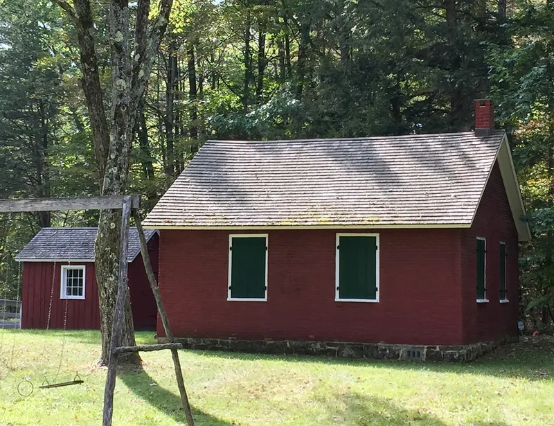

Why it's listed
Riders Mills is a small hamlet in the Town of Chatham, Columbia County, New York, set along Kinderhook Creek where water power once drove several mills. Eseck Mosher developed the early dam and mills in the late eighteenth century, and Jonathan Rider bought land there in 1802 and expanded the operations. The Rider family dominated the community until 1948. The mills, including saw, grist, fulling and carding operations, were swept away in a flood in 1869 and were not rebuilt, and the hamlet turned to farming. What remains is a group of houses in late Colonial, Greek Revival and Italianate styles, a brick one-room schoolhouse, a former saloon, a blacksmith's site, and many nineteenth century barns. Eight archeological sites, including mill foundations, a stone quarry and a covered bridge abutment, add to the district. It is recognized for its milling history, its intact nineteenth century architecture and its archeological potential.
Significance in brief: The district is significant as an early to mid-nineteenth century milling community developed by Eseck Mosher and the Jonathan Rider family until a flood in 1869 destroyed the mills. It also retains intact nineteenth century houses and barns, and archeological sites such as mill foundations, a quarry and a covered bridge abutment.
Machine-generated summary. This summary was generated by a language model from the official nomination document and has not been reviewed line by line by an editor. It may contain errors. Check the source document before relying on any detail. Source: nomination document (PDF) · National Archives catalog entry. NRHP reference 00000877, listed August 2, 2000. Summary generated October 2026 (model claude-sonnet-5-5, prompt v1.0-2026-10-29, confidence high).
Key facts
| Address | NY 66, Bachus Rd., Riders Mills Rd., Chatham |
|---|---|
| County | Columbia County |
| Listed | August 2, 2000 |
| Reference number | 00000877 |
| Resource type | District |
| Period of significance | ca. 1800-1948 |
| Architect / builder | unknown |
| Architectural style | Colonial (late 18th century) Georgian; Greek Revival; Late Victorian Italianate |
| Criteria |
|
| Areas of significance | Agriculture, Exploration/Settlement, Architecture, Industry, Historic - Non-Aboriginal, Community Planning and Development, Education |
| Level of significance | Local |
| Status (as stated in the nomination) | Most buildings are houses and outbuildings still in residential use; the brick schoolhouse, used as a school until the 1950s, is now used by the local historical society. |
| Acreage | 200 |
| Coordinates | 42.48232, -73.55960 (NPS GIS) |
What listing means for this property
This is a historic district. Buildings within its boundary are either contributing (they add to the district's significance) or non-contributing. Owners of contributing income-producing buildings can claim the 20% federal rehabilitation tax credit; homeowners should look at state credits. National Register districts impose no design review by themselves; a local historic district ordinance, if one exists, does (the difference explained).
General information, not legal or tax advice. Rules change; confirm with your State Historic Preservation Office or a qualified adviser.
Sources and further reading
- National Park Service, National Register of Historic Places database (snapshot May 2026), reference 00000877.
- Nomination form (PDF, National Archives) — catalog entry
- Wikipedia article (used for cross-checking only; text not reproduced here)
- Wikidata Q7332618
- This listing as JSON
Last updated October 2026. Found an error? See the editorial policy for how to report it.