St. Agnes Cemetery

Why it's listed
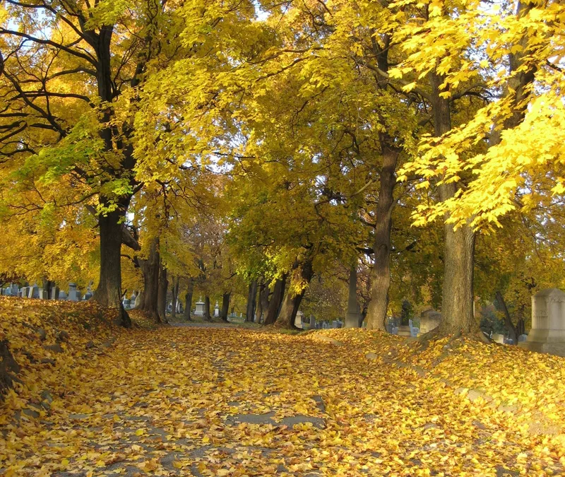
St. Agnes Cemetery is a 114-acre Catholic burial ground in Menands, north of Albany, beside Albany Rural Cemetery. It began in 1867 with 50 acres and grew through purchases in 1900 and 1938, then lost a little land to a state highway in 1952. The early section, laid out by engineers William H. Grant and Donald G. Mitchell, has winding roads and irregular lots on rolling hills, while later areas are more symmetrical. More than 50,000 burials are marked by mausoleums, monuments, Celtic crosses, shrines and simple flush stones in granite, marble, bronze and zinc. Interments include Albany political figures, a New York governor, Medal of Honor recipients, religious orders and remains moved from the old St. Mary's burial ground in Albany. The cemetery is significant as a record of Albany's Catholic and largely Irish immigrant community and of Catholic funerary art and cemetery design. It remains an active cemetery.
Significance in brief: The cemetery is described as illustrating Catholic funerary art and the growth of the Albany Catholic community, particularly its Irish immigrant population. It holds more than 50,000 burials, including prominent political, business, military and religious figures, as well as burials moved from the old St. Mary's Cemetery. Its landscape also reflects changing cemetery design across four development areas.
Machine-generated summary. This summary was generated by a language model from the official nomination document and has not been reviewed line by line by an editor. It may contain errors. Check the source document before relying on any detail. Source: nomination document (PDF) · National Archives catalog entry. NRHP reference 08000095, listed February 28, 2008. Summary generated October 2026 (model claude-sonnet-5-5, prompt v1.0-2026-10-29, confidence medium).
Key facts
| Address | 48 Cemetery Ave., Menands |
|---|---|
| County | Albany County |
| Listed | February 28, 2008 |
| Reference number | 08000095 |
| Resource type | Site |
| Architect / builder | William H. Grant and Donald G. Mitchell (early landscape engineers) |
| Areas of significance | Social History, Landscape Architecture, Art, Architecture, Black, Ethnic Heritage-Black |
| Level of significance | Local |
| Status (as stated in the nomination) | Still in use as a cemetery, with areas reserved for new burials; some historic features such as the Receiving Vault and the clergy lot marble have deteriorated. |
| Acreage | 114 |
| Coordinates | 42.70271, -73.72641 (NPS GIS) |
What listing means for this property
Sites (archaeological sites, battlefields, landscapes) are often listed with a restricted address to protect them from looting or disturbance. Listing is honorary for private owners; federal undertakings on or near the site go through Section 106 review, and state laws may protect burials and artefacts regardless of listing.
General information, not legal or tax advice. Rules change; confirm with your State Historic Preservation Office or a qualified adviser.
Sources and further reading
- National Park Service, National Register of Historic Places database (snapshot May 2026), reference 08000095.
- Nomination form (PDF, National Archives) — catalog entry
- Wikipedia article (used for cross-checking only; text not reproduced here)
- Wikidata Q7586711
- This listing as JSON
Last updated October 2026. Found an error? See the editorial policy for how to report it.