Bryan's Store

Why it's listed
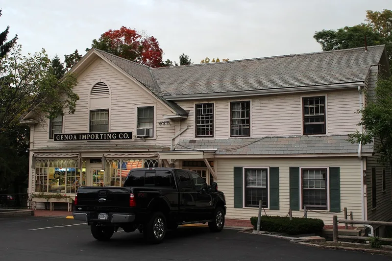
Bryan's Store is a long-serving commercial building at 435 Loudon Road in Loudonville, in the Town of Colonie. It began as a saloon and was moved to its present site during the second year of the Civil War, from across the road or possibly from the fairgrounds in Menands. Ralph A. Gove then opened it as the Loudonville store and post office, followed by William Woods, who kept the business the same. Arnol Bryan took over in 1926-27, and the post office moved elsewhere about 1932 while the grocery continued. Apartments were added later. The building has hand-hewn ceiling beams, intact saloon side windows that once opened onto a veranda, a slate roof and an old brick foundation. A rear barn was used for shoeing horses and still has tying rings and original doors. Set in a mixed residential and commercial area on the historic Albany-Mohawk Plank Road, it is valued as a community landmark.
Significance in brief: The building has served the Loudonville community since it was moved to the site, first as a store and post office and later as a grocery, and is regarded as a local landmark. It is also part of the historic Loudon Road (Albany-Mohawk Plank Road) corridor near Ireland's Corners, and was included in a survey of historic resources along Route 9.
Machine-generated summary. This summary was generated by a language model from the official nomination document and has not been reviewed line by line by an editor. It may contain errors. Check the source document before relying on any detail. Source: nomination document (PDF) · National Archives catalog entry. NRHP reference 79003246, listed October 4, 1979. Summary generated October 2026 (model claude-sonnet-5-5, prompt v1.0-2026-10-29, confidence medium).
Key facts
| Address | 435 Loudon Rd., Loudonville |
|---|---|
| County | Albany County |
| Listed | October 4, 1979 |
| Reference number | 79003246 |
| Resource type | Building |
| Areas of significance | Architecture |
| Level of significance | Local |
| Status (as stated in the nomination) | Currently in use as a grocery store and apartments; the store is open to the public. Threats listed include zoning, roads, developers and deterioration. |
| Acreage | 0.4 |
| Coordinates | 42.70568, -73.75425 (NPS GIS) |
What listing means for this property
For an income-producing building, listing (individually or as a contributing building in a district) is the gateway to the 20% federal rehabilitation tax credit on qualified rehabilitation costs, often stackable with state credits. Work claiming the credit must follow the Secretary of the Interior's Standards and be approved in advance.
Listing does not restrict a private owner acting without federal money or permits; where federal funding or licensing is involved, Section 106 review applies.
General information, not legal or tax advice. Rules change; confirm with your State Historic Preservation Office or a qualified adviser.
Sources and further reading
- National Park Service, National Register of Historic Places database (snapshot May 2026), reference 79003246.
- Nomination form (PDF, National Archives) — catalog entry
- Wikipedia article (used for cross-checking only; text not reproduced here)
- Wikidata Q4979924
- This listing as JSON
Last updated October 2026. Found an error? See the editorial policy for how to report it.