Putnam, Gen. Rufus, House
Also known as: Bliss-Murray-Putnam House

Why it's listed
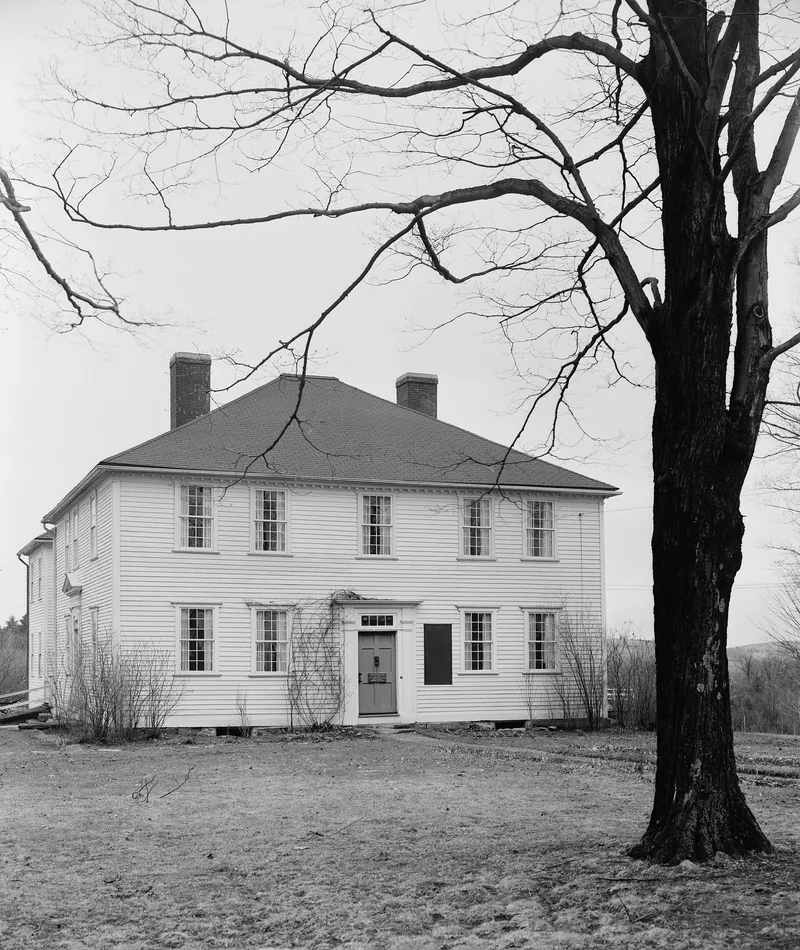
Built between 1760 and 1765 by John Murray, this two-story frame house in Rutland, Massachusetts, has a hipped roof, two interior brick chimneys and clapboarded walls. It measures 42 by 36 feet and faces south with a five-bay front. Inside, a center hall holds a fine stairway, and the rooms keep original pine wainscoting and fully panelled fireplace walls, some faced with blue Delft tiles. A 20th-century wing was added at the rear. Murray's daughter married Daniel Bliss, and the Blisses lived here until the state confiscated the farm because of their Loyalist stance. Rufus Putnam bought the house and 150 acres in 1781 and lived here until 1788. Putnam was a Revolutionary War engineer who planned the fortification of Dorchester Heights in 1776 and later led the first New England settlers to Marietta, Ohio. The house served as a museum from 1896 to 1950 and is now a private residence.
Significance in brief: The house was the home of Rufus Putnam from 1781 to 1788. Putnam was an engineer and soldier of the War for Independence and later organized settlement in the Northwest Territory. The house is also described as very well preserved and little altered.
Machine-generated summary. This summary was generated by a language model from the official nomination document and has not been reviewed line by line by an editor. It may contain errors. Check the source document before relying on any detail. Source: nomination document (PDF) · National Archives catalog entry. NRHP reference 72001330, listed November 28, 1972. Summary generated October 2026 (model claude-sonnet-5-5, prompt v1.0-2026-10-29, confidence high).
Key facts
| Address | 344 Main St., Rutland |
|---|---|
| County | Worcester County |
| Listed | November 28, 1972 |
| Reference number | 72001330 |
| Resource type | Building |
| Period of significance | 1781-1788 |
| Architect / builder | John Murray |
| Areas of significance | Military |
| Level of significance | National |
| National Historic Landmark | Yes, designated November 28, 1972 |
| Status (as stated in the nomination) | Excellent condition and little altered; used as a private residence and not open to visitors. |
| Acreage | 135 |
| Coordinates | 42.37488, -71.97079 (NPS GIS) |
What listing means for this property
National Register listing is honorary for a privately owned home: it does not by itself restrict what an owner may do with their own money, and it does not require public access. Restrictions come from local landmark or historic-district ordinances, which are separate (how they differ).
Owner-occupied houses are not eligible for the 20% federal rehabilitation tax credit, which applies to income-producing buildings, but many states offer credits for homeowners. Listing also opens the door to preservation easements and to buying a plaque. Start with what listing means for homeowners, renovating a listed house and selling one.
General information, not legal or tax advice. Rules change; confirm with your State Historic Preservation Office or a qualified adviser.
Sources and further reading
- National Park Service, National Register of Historic Places database (snapshot May 2026), reference 72001330.
- Nomination form (PDF, National Archives) — catalog entry
- Wikipedia article (used for cross-checking only; text not reproduced here)
- Wikidata Q5532163
- This listing as JSON
Last updated October 2026. Found an error? See the editorial policy for how to report it.