Huguenot Fort

Why it's listed
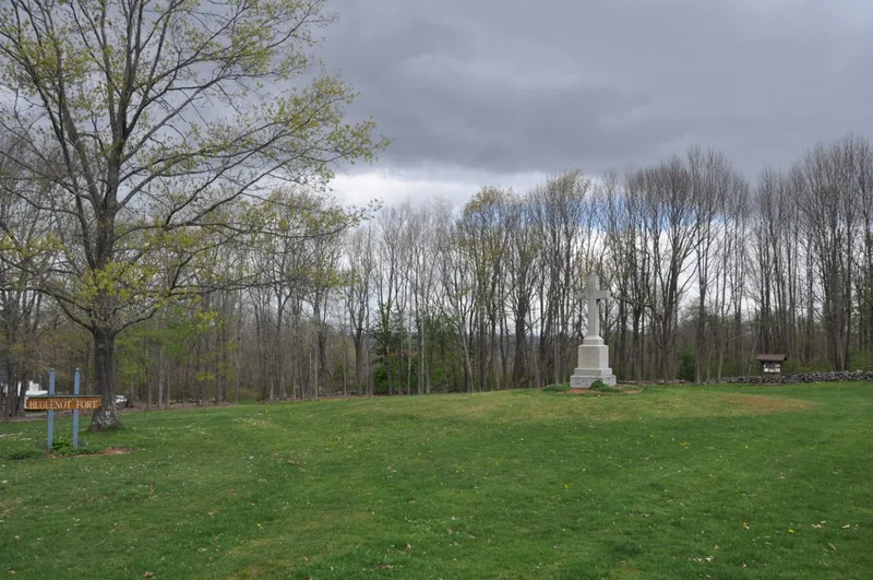
On a high hill in southwestern Oxford, Massachusetts, lie the ruins and buried remains of a stone fort built by French Protestant (Huguenot) settlers by 1694. The settlers arrived in 1687 and left in 1696, with a possible return between 1699 and 1704. The fort had a rectangular plan with two diagonally opposed bastions, a blockhouse, a powder magazine and a well. It is probably the first stone fort built in Massachusetts. Excavations and restorations in 1884 and around 1925 disturbed parts of the interior. Test excavations in 1983 and 1984 found the massive north wall intact and the southern third of the interior undisturbed. Artifacts included pipestems, earthenware, a lead cloth seal and a flintlock part. The site was listed for its archaeological potential, its rare surviving early fort design, and its record of a French community on the English frontier during King William's War and Queen Anne's War.
Significance in brief: It is the most visible and intact remnant of a short-lived French Protestant settlement on the Massachusetts Bay Colony's interior frontier. It is probably the first stone fort in Massachusetts, and most of the site remains undisturbed. It offers research potential on seventeenth-century fort design and on a French community within an English region.
Machine-generated summary. This summary was generated by a language model from the official nomination document and has not been reviewed line by line by an editor. It may contain errors. Check the source document before relying on any detail. Source: nomination document (PDF) · National Archives catalog entry. NRHP reference 88000424, listed April 27, 1988. Summary generated October 2026 (model claude-sonnet-5-5, prompt v1.0-2026-10-29, confidence high).
Key facts
| Address | Fort Hill Rd., Oxford |
|---|---|
| County | Worcester County |
| Listed | April 27, 1988 |
| Reference number | 88000424 |
| Resource type | Site |
| Period of significance | 1687-1704 |
| Criteria |
|
| Areas of significance | Community Planning and Development, Historic - Non-Aboriginal, Military, Exploration/Settlement, Architecture |
| Level of significance | State, Local |
| Status (as stated in the nomination) | Ruins and buried remains, partly obscured by saplings, vines and leaf cover; owned by the town and used for outdoor recreation. |
| Acreage | 8.7 |
| Coordinates | 42.09846, -71.84684 (NPS GIS) |
What listing means for this property
Sites (archaeological sites, battlefields, landscapes) are often listed with a restricted address to protect them from looting or disturbance. Listing is honorary for private owners; federal undertakings on or near the site go through Section 106 review, and state laws may protect burials and artefacts regardless of listing.
General information, not legal or tax advice. Rules change; confirm with your State Historic Preservation Office or a qualified adviser.
Sources and further reading
- National Park Service, National Register of Historic Places database (snapshot May 2026), reference 88000424.
- Nomination form (PDF, National Archives) — catalog entry
- Wikipedia article (used for cross-checking only; text not reproduced here)
- Wikidata Q5934700
- This listing as JSON
Last updated October 2026. Found an error? See the editorial policy for how to report it.