Camp Atwater
Also known as: David Fisher Atwater Camp

Why it's listed
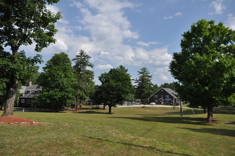
Camp Atwater is a summer camp of 67 acres on Lake Lashaway in North Brookfield, Massachusetts, divided by Shore Road. About fifty acres remain undeveloped. The grounds hold twenty-four buildings, mostly built between 1921 and 1945, including a Main Lodge, Recreation Hall, Dining Hall and small campers' huts, plus a beach, courts and ball fields. The oldest structure is the White Cottage, built in 1760, which housed the first campers. The camp began in 1921 when Mary Atwater of Springfield donated 60 acres to Dr. William DeBerry in memory of her father, David Fisher Atwater. Forty Black children attended that first season. It is described as the first and only recognized camp for Black youth in the country, drawing campers from across the nation. Alumni include a Detroit mayor, a four-star general and a university chancellor. The site may also hold prehistoric remains, since it lies near the Drake Site.
Significance in brief: The nomination calls it the first and only recognized camp for Black children in the country. It argues that many of its alumni went on to distinguish themselves in public life. It also notes the potential for prehistoric archaeological remains, given its proximity to the Drake Site.
Machine-generated summary. This summary was generated by a language model from the official nomination document and has not been reviewed line by line by an editor. It may contain errors. Check the source document before relying on any detail. Source: nomination document (PDF) · National Archives catalog entry. NRHP reference 82004477, listed April 15, 1982. Summary generated October 2026 (model claude-sonnet-5-5, prompt v1.0-2026-10-29, confidence high).
Key facts
| Address | Shore Rd., North Brookfield |
|---|---|
| County | Worcester County |
| Listed | April 15, 1982 |
| Reference number | 82004477 |
| Resource type | Building |
| Period of significance | 1921-1922 |
| Criteria |
|
| Areas of significance | Prehistoric, Entertainment/Recreation, Black, Social History |
| Level of significance | State, Local |
| Status (as stated in the nomination) | Described as occupied, with work in progress, and as unaltered on its original site; used for recreation. |
| Acreage | 67 |
| Coordinates | 42.23952, -72.04957 (NPS GIS) |
What listing means for this property
National Register listing is honorary: it recognises significance and does not restrict what a private owner may do without federal money or permits. It unlocks the 20% federal rehabilitation tax credit for income-producing buildings, state credits in many states, and Section 106 review when federal agencies are involved. See what listing means in practice.
General information, not legal or tax advice. Rules change; confirm with your State Historic Preservation Office or a qualified adviser.
Sources and further reading
- National Park Service, National Register of Historic Places database (snapshot May 2026), reference 82004477.
- Nomination form (PDF, National Archives) — catalog entry
- Wikipedia article (used for cross-checking only; text not reproduced here)
- Wikidata Q5026983
- This listing as JSON
Last updated October 2026. Found an error? See the editorial policy for how to report it.