South Middleborough Historic District

Why it's listed
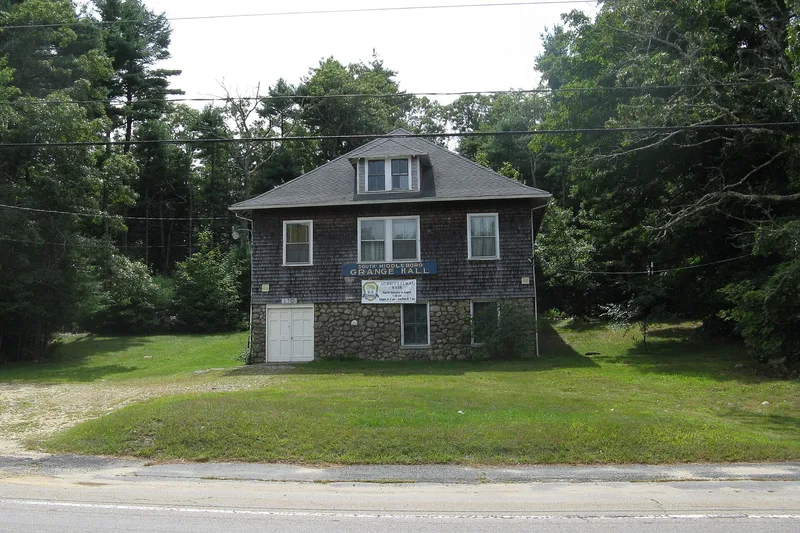
South Middleborough is a roadside village about six and a half miles south of Middleborough center, laid out along Wareham, Locust, and Spruce Streets over roughly 88 acres. Until 1960 these streets formed one of two principal routes between Boston and the summer resorts of Cape Cod. The district holds 75 contributing resources built between the late 18th and mid-20th centuries, including a ca. 1773 Baptist parsonage, Cape-style and Greek Revival houses, the stuccoed stone house of 1828, a church begun in 1841, a school, a grange hall, a fire station, and Sisson's Diner of about 1901. The village grew after the Cape Cod Branch Railroad arrived in 1848, when local farmers and mill owners such as the Benson family could ship lumber, boxboards, and other products to distant markets. Houses of mill owners and workers remained small and restrained. Later commercial buildings reflect the era of automobile travel toward Cape Cod.
Significance in brief: The district preserves a small rural village core that grew around the 1848 arrival of the Cape Cod Branch Railroad and the local lumber milling industry. Its modest houses, church, school, grange hall, fire station, and early roadside commercial buildings, including Sisson's Diner, illustrate the community's agricultural, milling, and later automobile-era development. The form identifies Sisson's Diner (ca. 1901) as the most significant building.
Machine-generated summary. This summary was generated by a language model from the official nomination document and has not been reviewed line by line by an editor. It may contain errors. Check the source document before relying on any detail. Source: nomination document (PDF) · National Archives catalog entry. NRHP reference 09000438, listed June 19, 2009. Summary generated October 2026 (model claude-sonnet-5-5, prompt v1.0-2026-10-29, confidence medium).
Key facts
| Address | Locust, Spruce, and Wareham Sts., Middleborough |
|---|---|
| County | Plymouth County |
| Listed | June 19, 2009 |
| Reference number | 09000438 |
| Resource type | District |
| Architectural style | New England Colonial, Greek Revival, Colonial Revival, Tudor Revival, Bungalow, Craftsman, Commercial |
| Areas of significance | Architecture, Commerce, Social History, Transportation |
| Level of significance | Local |
| Status (as stated in the nomination) | Mix of continuing residential, commercial, religious, and civic uses; the cemetery, church, and fire station remain in their historic functions. |
| Acreage | 88 |
| Coordinates | 41.82389, -70.82739 (NPS GIS) |
What listing means for this property
This is a historic district. Buildings within its boundary are either contributing (they add to the district's significance) or non-contributing. Owners of contributing income-producing buildings can claim the 20% federal rehabilitation tax credit; homeowners should look at state credits. National Register districts impose no design review by themselves; a local historic district ordinance, if one exists, does (the difference explained).
General information, not legal or tax advice. Rules change; confirm with your State Historic Preservation Office or a qualified adviser.
Sources and further reading
- National Park Service, National Register of Historic Places database (snapshot May 2026), reference 09000438.
- Nomination form (PDF, National Archives) — catalog entry
- Wikipedia article (used for cross-checking only; text not reproduced here)
- Wikidata Q17061875
- This listing as JSON
Last updated October 2026. Found an error? See the editorial policy for how to report it.