South Hingham Historic District

Why it's listed
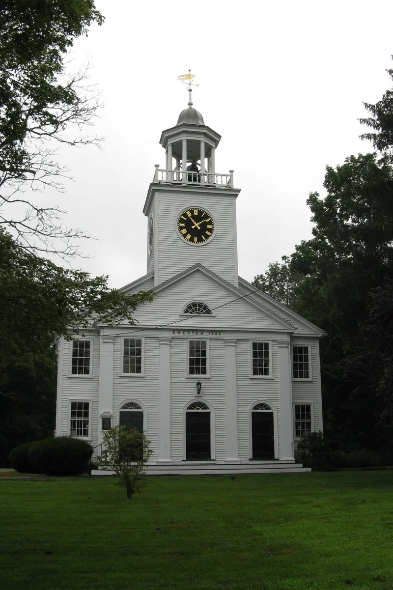
South Hingham Historic District covers about 1.1 miles of Main Street in Hingham, Massachusetts, running from 528 to 781 Main Street across the Glad Tidings Plain. Its most distinctive feature is the broad street, laid out in the 17th century at twelve rods wide and now lined with frontage roads and mature shade trees. The district counts 158 contributing resources, including 143 buildings. Houses range from the 1650 Edward Wilder House to Colonial Revival homes of the 1940s. Seventy-five buildings from 1650 to 1850 show Colonial, Federal and Greek Revival styles, and local builders kept traditional details well into the later 19th century. Other resources include the 1742 Second Parish Church, a 1905 cemetery chapel, an 1878 memorial building, a 1754 milestone and a 17th-century dam at Cushing Pond. Mills, toy making, shoemaking, clockmaking and the building trades shaped the neighborhood's economy and appear in its history.
Significance in brief: The district holds a dense collection of New England Colonial, Federal and Greek Revival architecture, with the earliest house dating to 1650. Its unusually wide 17th-century street, lined with frontage roads and shade trees, preserves early town planning and a village landscape. It also documents local industries and trades such as milling, toy making, shoemaking and clockmaking.
Machine-generated summary. This summary was generated by a language model from the official nomination document and has not been reviewed line by line by an editor. It may contain errors. Check the source document before relying on any detail. Source: nomination document (PDF) · National Archives catalog entry. NRHP reference 98000838, listed July 24, 1998. Summary generated October 2026 (model claude-sonnet-5-5, prompt v1.0-2026-10-29, confidence medium).
Key facts
| Address | Roughly along Main St., from Cushing St. to Tower Brook Rd., Hingham |
|---|---|
| County | Plymouth County |
| Listed | July 24, 1998 |
| Reference number | 98000838 |
| Resource type | District |
| Architectural style | Colonial / New England Colonial; Early Republic/Federal; Mid 19th Century/Greek Revival; Late Victorian (Italianate, Second Empire, Shingle Style); Late 19th-Early 20th Century Revivals (Colonial, Gothic) |
| Areas of significance | Agriculture, Architecture, Historic - Non-Aboriginal, Conservation, Religion, Social History |
| Level of significance | Local |
| Status (as stated in the nomination) | Largely in current use as private residences, along with churches, a cemetery chapel, shops and conservation land. |
| Acreage | 224.5 |
| Coordinates | 42.21251, -70.88077 (NPS GIS) |
What listing means for this property
This is a historic district. Buildings within its boundary are either contributing (they add to the district's significance) or non-contributing. Owners of contributing income-producing buildings can claim the 20% federal rehabilitation tax credit; homeowners should look at state credits. National Register districts impose no design review by themselves; a local historic district ordinance, if one exists, does (the difference explained).
General information, not legal or tax advice. Rules change; confirm with your State Historic Preservation Office or a qualified adviser.
Sources and further reading
- National Park Service, National Register of Historic Places database (snapshot May 2026), reference 98000838.
- Nomination form (PDF, National Archives) — catalog entry
- Wikipedia article (used for cross-checking only; text not reproduced here)
- Wikidata Q7567488
- This listing as JSON
Last updated October 2026. Found an error? See the editorial policy for how to report it.