Graves Light Station

Why it's listed
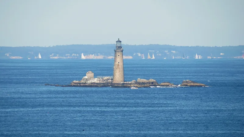
Graves Light is a round granite tower on Graves Ledge, marking the approach to Boston Harbor from the waters off Hull, Massachusetts. Lighthouse builder Royal Luther of Malden supervised construction in 1903. Granite was cut at Cape Ann, work at the ledge began on 1 June 1903, and the first stone was landed on 11 August. The first lens came from Paris, and the station was ready to operate by midsummer 1905. A granite oil house with a connecting footbridge was added to the south. Inside, the tower is arranged in stages, with a cistern, an engine room for the fog horn, a kitchen, a bunk room, a library and watch room, and the light mechanism beneath the lantern. At one time its beam, at 380,000 candlepower, was the strongest in Massachusetts. The light stands near the site of several wrecks, including the City of Salisbury in 1938 and the Mary E. O'Hara in 1941. The ledge was named for Thomas Graves, an early colonial trader.
Significance in brief: The nomination presents the station as an aid to navigation that once had the most powerful beam in Massachusetts, at 380,000 candlepower. It also records the light's role in several shipwrecks and rescues nearby, including the 1938 loss of the City of Salisbury, described as the most spectacular shipping disaster in Boston Harbor history.
Machine-generated summary. This summary was generated by a language model from the official nomination document and has not been reviewed line by line by an editor. It may contain errors. Check the source document before relying on any detail. Source: nomination document (PDF) · National Archives catalog entry. NRHP reference 87002041, listed September 28, 1987. Summary generated October 2026 (model claude-sonnet-5-5, prompt v1.0-2026-10-29, confidence medium).
Key facts
| Address | N of Hull in the Massachusetts Bay, Hull |
|---|---|
| County | Plymouth County |
| Listed | September 28, 1987 |
| Reference number | 87002041 |
| Resource type | Structure |
| Period of significance | 1900- |
| Architect / builder | Royal Luther |
| Areas of significance | Engineering, Transportation, Architecture, Maritime History |
| Level of significance | State |
| Status (as stated in the nomination) | Listed as fair condition, unaltered and on its original site; the light has been automated. The form marks the property as unoccupied and owned by the U.S. Coast Guard. |
| Acreage | 0.1 |
| Coordinates | 42.36508, -70.86915 (NPS GIS) |
What listing means for this property
For a publicly owned building or structure, listing mainly matters when federal funds, permits or licences are involved: projects then go through Section 106 review so effects on the property are considered. Listing also strengthens applications for preservation grants and, for leased income-producing uses, can enable the federal rehabilitation tax credit.
General information, not legal or tax advice. Rules change; confirm with your State Historic Preservation Office or a qualified adviser.
Sources and further reading
- National Park Service, National Register of Historic Places database (snapshot May 2026), reference 87002041.
- Nomination form (PDF, National Archives) — catalog entry
- Wikipedia article (used for cross-checking only; text not reproduced here)
- Wikidata Q14537875
- This listing as JSON
Last updated October 2026. Found an error? See the editorial policy for how to report it.