First Parish Church

Why it's listed
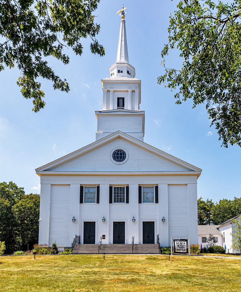
Set back from Tremont Street on a small rise in Duxbury, this church was built in 1840 of native Duxbury pine and designed to seat one thousand. It is the congregation's fourth meetinghouse and the third on the site. The rectangular building measures 86 feet deep and 66 feet wide, with a 127-foot steeple rising in three stages from the roof ridge. The five-bay east facade has wide pilasters, three entrances, and an oculus in the gable. Inside, the large room has no supporting columns and holds white wainscotted box pews with mahogany rails. A parish house was attached on the north in 1958. The congregation was organized in 1632 and gathered by Elder William Brewster, marking the settlement's permanence. The bell tower holds the 1819 town bell, made by George Handel Holbrook, a former Revere apprentice. The congregation became Unitarian and merged with the Universalist Church in 1961. The building was listed for its architecture and its role in local history.
Significance in brief: The nomination cites its architecture and its role in Duxbury's history. The congregation dates to 1632 and was gathered by Elder William Brewster. The refined design, grand size and finish reflect the height of Duxbury's seafaring wealth.
Machine-generated summary. This summary was generated by a language model from the official nomination document and has not been reviewed line by line by an editor. It may contain errors. Check the source document before relying on any detail. Source: nomination document (PDF) · National Archives catalog entry. NRHP reference 78001404, listed July 21, 1978. Summary generated October 2026 (model claude-sonnet-5-5, prompt v1.0-2026-10-29, confidence medium).
Key facts
| Address | SW of Duxbury at Tremont and Depot Sts., Duxbury |
|---|---|
| County | Plymouth County |
| Listed | July 21, 1978 |
| Reference number | 78001404 |
| Resource type | Building |
| Period of significance | 1840 |
| Areas of significance | Architecture |
| Level of significance | Local |
| Status (as stated in the nomination) | Occupied; owned by a private religious congregation. An ell-shaped parish house was added on the north in 1958. |
| Acreage | 3.3 |
| Within district | Old Town Hall Historic District |
| Coordinates | 42.03497, -70.69200 (NPS GIS) |
What listing means for this property
Religious properties are listed for their architectural or historical significance, not their religious use. Listing is honorary and does not restrict the congregation's use of the building. The federal rehabilitation credit is generally unavailable unless part of the building is income-producing; some state programmes and preservation grants do cover religious buildings. Federal funding or permits trigger Section 106 review.
General information, not legal or tax advice. Rules change; confirm with your State Historic Preservation Office or a qualified adviser.
Sources and further reading
- National Park Service, National Register of Historic Places database (snapshot May 2026), reference 78001404.
- Nomination form (PDF, National Archives) — catalog entry
- Wikipedia article (used for cross-checking only; text not reproduced here)
- Wikidata Q5453479
- This listing as JSON
Last updated October 2026. Found an error? See the editorial policy for how to report it.