Sullivan's Corner Historic District
Also known as: North Wrentham

Why it's listed
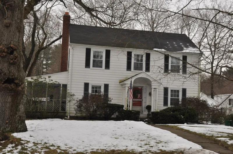
Sullivan's Corner is a small historic crossroads in northeastern Norfolk, Massachusetts, where Main, Needham and Seekonk Streets meet. The district covers about eighteen acres, roughly a quarter of it taken up by Norfolk Cemetery, which dates to 1736 and 1745 and is now town-owned. Its grave markers run from early slate stones with winged skulls to Victorian Gothic marble and 20th-century granite blocks. Five other properties surround the cemetery: the Ware-Love House (ca. 1830), the Blake-Pond-Meehan House, a Greek Revival cape described as one of the best preserved in Norfolk, Sullivan's Store (ca. 1913), a corner store form not seen elsewhere in town, and the Colonial Revival Phelan House (ca. 1936). Records tie the buildings to local farming families, including Irish immigrants who bought property here in the 1800s. The district was listed because it keeps a continuous village streetscape that nearby newer construction does not match.
Significance in brief: The district preserves a village crossroads with a continuous historic streetscape that adjacent construction lacks. It includes a Colonial-era cemetery with a range of grave marker styles, a well-preserved Greek Revival cape, and a rare early 20th-century corner store. The properties also reflect the Irish immigrant and farming families who lived there and the later growth of the area as Sullivan's Corner.
Machine-generated summary. This summary was generated by a language model from the official nomination document and has not been reviewed line by line by an editor. It may contain errors. Check the source document before relying on any detail. Source: nomination document (PDF) · National Archives catalog entry. NRHP reference 12000340, listed June 15, 2012. Summary generated October 2026 (model claude-sonnet-5-5, prompt v1.0-2026-10-29, confidence medium).
Key facts
| Address | Roughly jct. of Main, Needham, & Seekonk Sts., Norfolk |
|---|---|
| County | Norfolk County |
| Listed | June 15, 2012 |
| Reference number | 12000340 |
| Resource type | District |
| Architectural style | Late 19th-Early 20th Century Revivals: Greek Revival, Colonial Revival |
| Areas of significance | Architecture, Community Planning and Development, Social History |
| Level of significance | Local |
| Status (as stated in the nomination) | The properties other than the cemetery are in residential use, including the former grocery store, which was converted to a dwelling during the period of significance. The cemetery remains in use and is town-owned. |
| Acreage | 18 |
| Coordinates | 42.12197, -71.31286 (NPS GIS) |
What listing means for this property
This is a historic district. Buildings within its boundary are either contributing (they add to the district's significance) or non-contributing. Owners of contributing income-producing buildings can claim the 20% federal rehabilitation tax credit; homeowners should look at state credits. National Register districts impose no design review by themselves; a local historic district ordinance, if one exists, does (the difference explained).
General information, not legal or tax advice. Rules change; confirm with your State Historic Preservation Office or a qualified adviser.
Sources and further reading
- National Park Service, National Register of Historic Places database (snapshot May 2026), reference 12000340.
- Nomination form (PDF, National Archives) — catalog entry
- Wikipedia article (used for cross-checking only; text not reproduced here)
- Wikidata Q16900865
- This listing as JSON
Last updated October 2026. Found an error? See the editorial policy for how to report it.