Walden Street Cattle Pass

Why it's listed
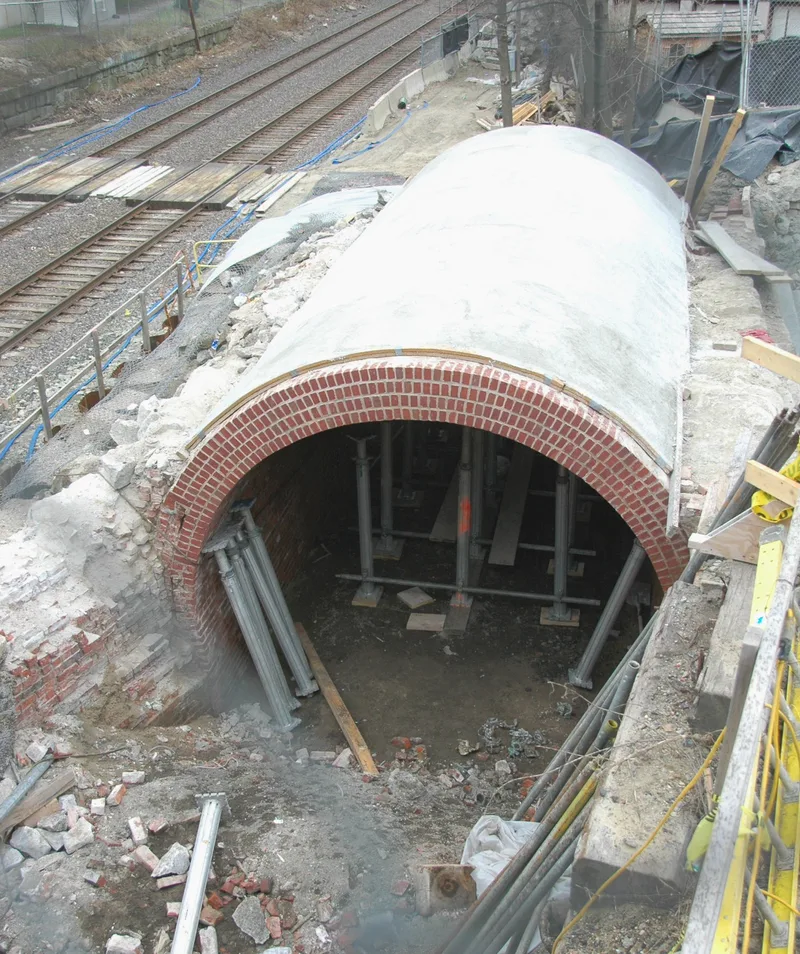
Beside the Walden Street bridge in North Cambridge, a small brick tunnel runs beneath the road approach to the railroad cut. Built in 1857 of soft red common brick, the arched pass measures about 30 feet long, 12 feet wide and 8 feet 10 inches high, with an earthen floor. It was built when Walden Street was laid across land owned by Henry Potter, a wealthy beef packer and provision dealer. The new street would have cut his feedlots in two, so the tunnel let his cattle pass freely between the sections. Its use ended around 1869, when Potter closed his slaughterhouse and sold the land for house lots. The pass is therefore linked to Cambridge's cattle trade around Porter Square and to the neighborhood's change into a residential suburb. Today the brick is heavily weathered, the approaches are overgrown, and graffiti covers the walls, though the structure appears sound. The adjoining bridge has been rebuilt several times and is not part of the listing.
Significance in brief: The pass is argued to be locally significant under Criteria A and B. It reflects the mid-19th-century Cambridge cattle trade around Porter Square and the area's later suburbanization. It is also tied to Henry Potter, a provision merchant whose cattle business depended on it.
Machine-generated summary. This summary was generated by a language model from the official nomination document and has not been reviewed line by line by an editor. It may contain errors. Check the source document before relying on any detail. Source: nomination document (PDF) · National Archives catalog entry. NRHP reference 94000554, listed June 3, 1994. Summary generated October 2026 (model claude-sonnet-5-5, prompt v1.0-2026-10-29, confidence high).
Key facts
| Address | Adjacent to MBTA right-of-way at Walden St., Cambridge |
|---|---|
| County | Middlesex County |
| Listed | June 3, 1994 |
| Reference number | 94000554 |
| Resource type | Structure |
| Period of significance | 1857 - 1869 |
| Architect / builder | Unknown |
| Architectural style | No Style |
| Criteria |
|
| Areas of significance | Agriculture, Commerce, Community Planning and Development |
| Level of significance | Local |
| Status (as stated in the nomination) | Listed as vacant/not in use; surfaces are severely deteriorated though the structure appears sound, and it has been used as a shelter and covered with graffiti. |
| Acreage | 0.9 |
| Coordinates | 42.38926, -71.12474 (NPS GIS) |
What listing means for this property
National Register listing is honorary: it recognises significance and does not restrict what a private owner may do without federal money or permits. It unlocks the 20% federal rehabilitation tax credit for income-producing buildings, state credits in many states, and Section 106 review when federal agencies are involved. See what listing means in practice.
Noted as vacant in the nomination. Nomination documents can be decades old; current status may differ. If you are considering buying an empty listed property, read the due-diligence checklist.
General information, not legal or tax advice. Rules change; confirm with your State Historic Preservation Office or a qualified adviser.
Sources and further reading
- National Park Service, National Register of Historic Places database (snapshot May 2026), reference 94000554.
- Nomination form (PDF, National Archives) — catalog entry
- Wikipedia article (used for cross-checking only; text not reproduced here)
- Wikidata Q7961482
- This listing as JSON
Last updated October 2026. Found an error? See the editorial policy for how to report it.