Reading Standpipe

Why it's listed
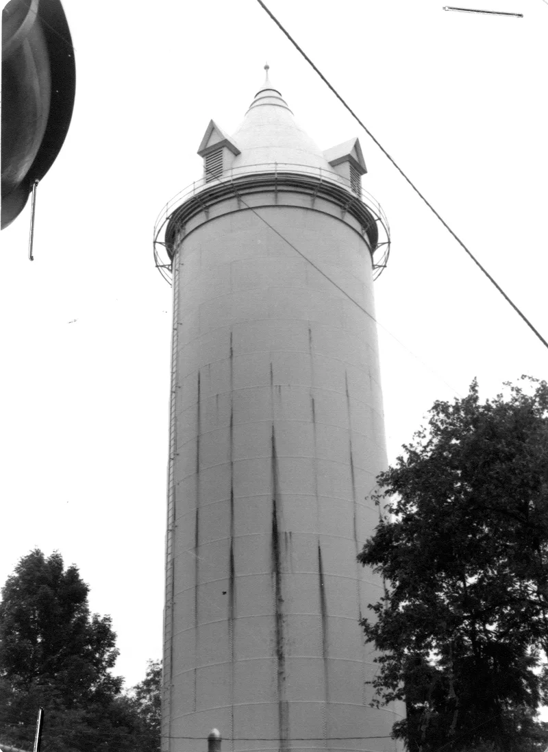
Rising 138 feet on a hilltop at Auburn and Beacon Streets, this wrought iron and steel standpipe is 30 feet in diameter and still serves Reading as a water reservoir. It was built in 1890-91 as part of the town's first public water system, which also included 20.5 miles of pipe, 111 hydrants and a steam-powered pumping station, at a total cost of $185,331.75. The town had pursued a water supply since 1883 because of chronic shortages for firefighting and rising demand from a growing population, and fires had devastated it with some frequency. After a private company was chartered in 1885, the General Court settled the matter in favor of town ownership in 1889. Beyond its role in the water system, the standpipe is valued as a landmark. Standing on a hill and visible from many points, it resembles a medieval tower in design. It retains its original location, design, materials and workmanship, and is in good condition.
Significance in brief: It was part of Reading's first public water system, built after chronic water shortages for firefighting and a growing population. It is also a prominent visual landmark on the town skyline, visible from many points. Its design resembles a medieval tower. The form says it meets Criteria A and C and retains integrity of location, design, materials, workmanship and feeling.
Machine-generated summary. This summary was generated by a language model from the official nomination document and has not been reviewed line by line by an editor. It may contain errors. Check the source document before relying on any detail. Source: nomination document (PDF) · National Archives catalog entry. NRHP reference 85000549, listed February 1, 1985. Summary generated October 2026 (model claude-sonnet-5-5, prompt v1.0-2026-10-29, confidence medium).
Key facts
| Address | Auburn and Beacon Sts., Reading |
|---|---|
| County | Middlesex County |
| Listed | February 1, 1985 |
| Reference number | 85000549 |
| Resource type | Structure |
| Architectural style | Medieval-tower-like design |
| Criteria |
|
| Areas of significance | Community Planning and Development, Architecture |
| Level of significance | Local |
| Status (as stated in the nomination) | Listed in good condition; present use is as a water reservoir. |
| Acreage | 1.5 |
| Coordinates | 42.53118, -71.10545 (NPS GIS) |
What listing means for this property
National Register listing is honorary: it recognises significance and does not restrict what a private owner may do without federal money or permits. It unlocks the 20% federal rehabilitation tax credit for income-producing buildings, state credits in many states, and Section 106 review when federal agencies are involved. See what listing means in practice.
General information, not legal or tax advice. Rules change; confirm with your State Historic Preservation Office or a qualified adviser.
Sources and further reading
- National Park Service, National Register of Historic Places database (snapshot May 2026), reference 85000549.
- Nomination form (PDF, National Archives) — catalog entry
- Wikipedia article (used for cross-checking only; text not reproduced here)
- Wikidata Q7300567
- This listing as JSON
Last updated October 2026. Found an error? See the editorial policy for how to report it.