Lexington Green
Also known as: See Also: Lexington Green Historic District; Lexington Common; Battle Green

Why it's listed
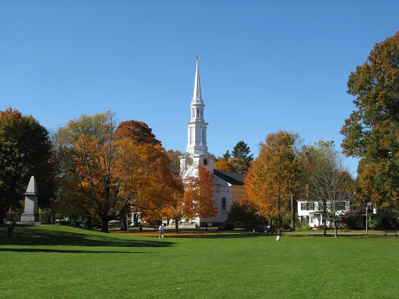
Lexington Green is a triangular, 2.5-acre public park in Lexington, Massachusetts, bounded by Massachusetts Avenue, Harrington Road and Bedford Street. The town bought 1.5 acres in 1711 and another acre in 1722 for a common and militia training field. On the morning of April 19, 1775, about 75 local militia under Captain John Parker faced a British advance guard led by Major John Pitcairn. A shot was fired, the British delivered a volley, and eight Americans were killed and ten wounded. The clash delayed the march toward Concord by little more than half an hour but opened the Revolutionary War. Today the Green holds several memorials: Henry Hudson Kitson's Minute Man statue, dedicated in 1900; a plaque marking the belfry site; a boulder marking the east end of the militia line; and a granite obelisk of 1799 over the tomb of seven of the dead. The Green is now owned and maintained by the Town.
Significance in brief: The Green was the site of the brief skirmish on April 19, 1775 between Lexington Minute Men and British troops. Eight Americans were killed and ten wounded, and the encounter is described as the start of the armed struggle for American independence. Monuments on the Green commemorate the event.
Machine-generated summary. This summary was generated by a language model from the official nomination document and has not been reviewed line by line by an editor. It may contain errors. Check the source document before relying on any detail. Source: nomination document (PDF) · National Archives catalog entry. NRHP reference 66000767, listed October 15, 1966. Summary generated October 2026 (model claude-sonnet-5-5, prompt v1.0-2026-10-29, confidence medium).
Key facts
| Address | Massachusetts and Hancock Sts., Lexington |
|---|---|
| County | Middlesex County |
| Listed | October 15, 1966 |
| Reference number | 66000767 |
| Resource type | Site |
| Period of significance | 18th Century (specific dates 1711 and 1722; April 19, 1775) |
| Areas of significance | Military |
| Level of significance | National |
| National Historic Landmark | Yes, designated January 20, 1961 |
| Status (as stated in the nomination) | Maintained by the Town as a public park and memorial; condition marked good, altered, on its original site, and open to the public without restriction. |
| Acreage | 2.5 |
| Coordinates | 42.44952, -71.23127 (NPS GIS) |
What listing means for this property
Sites (archaeological sites, battlefields, landscapes) are often listed with a restricted address to protect them from looting or disturbance. Listing is honorary for private owners; federal undertakings on or near the site go through Section 106 review, and state laws may protect burials and artefacts regardless of listing.
General information, not legal or tax advice. Rules change; confirm with your State Historic Preservation Office or a qualified adviser.
Sources and further reading
- National Park Service, National Register of Historic Places database (snapshot May 2026), reference 66000767.
- Nomination form (PDF, National Archives) — catalog entry
- Wikipedia article (used for cross-checking only; text not reproduced here)
- Wikidata Q4257679
- This listing as JSON
Last updated October 2026. Found an error? See the editorial policy for how to report it.