Fort Washington

Why it's listed
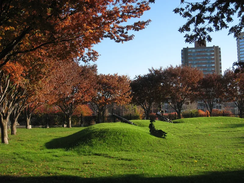
Fort Washington is a small public park at 95 Waverly Street in Cambridge, Massachusetts, centered on a semicircular earthen battery from 1775. The battery was one of several half-moon fortifications ordered by General Washington to guard Cambridge against attack from the river, and it is the only Revolutionary fortification still surviving in the city. It measures about 120 feet across and has three openings for artillery facing southeast, south and southwest. In 1857 the Dana family deeded the land to the city, which worked with the Commonwealth to restore the battery, landscape the grounds and mount three 18-pound cannon obtained from Fort Warren in Boston Harbor. An elaborate granite and iron fence designed by John R. Hall followed in 1858, with cannon-shaped posts and spear and halberd pickets. Bronze tablets were added in 1928. The site is valued both for its Revolutionary War associations and as an early preservation effort.
Significance in brief: It is the only surviving Revolutionary fortification in Cambridge, one of a series of half-moon batteries built in 1775 by order of General Washington to protect the town from attack by river. It is also considered an early example of historic preservation by private and public groups, since the Dana family gave the land to the city in 1857 for use as a park.
Machine-generated summary. This summary was generated by a language model from the official nomination document and has not been reviewed line by line by an editor. It may contain errors. Check the source document before relying on any detail. Source: nomination document (PDF) · National Archives catalog entry. NRHP reference 73000284, listed April 3, 1973. Summary generated October 2026 (model claude-sonnet-5-5, prompt v1.0-2026-10-29, confidence medium).
Key facts
| Address | 95 Waverly St., Cambridge |
|---|---|
| County | Middlesex County |
| Listed | April 3, 1973 |
| Reference number | 73000284 |
| Resource type | Structure |
| Architect / builder | John R. Hall, architect (1858 fence) |
| Areas of significance | Landscape Architecture, Conservation, Military |
| Level of significance | State, Local |
| Status (as stated in the nomination) | Park in good condition; the fence was described as needing further repair. Repairs and improvements were made in 1903, 1928 and 1966. |
| Acreage | 0.7 |
| Coordinates | 42.35650, -71.10421 (NPS GIS) |
What listing means for this property
National Register listing is honorary: it recognises significance and does not restrict what a private owner may do without federal money or permits. It unlocks the 20% federal rehabilitation tax credit for income-producing buildings, state credits in many states, and Section 106 review when federal agencies are involved. See what listing means in practice.
General information, not legal or tax advice. Rules change; confirm with your State Historic Preservation Office or a qualified adviser.
Sources and further reading
- National Park Service, National Register of Historic Places database (snapshot May 2026), reference 73000284.
- Nomination form (PDF, National Archives) — catalog entry
- Wikipedia article (used for cross-checking only; text not reproduced here)
- Wikidata Q5472257
- This listing as JSON
Last updated October 2026. Found an error? See the editorial policy for how to report it.