Boxborough Old Town Center

Why it's listed
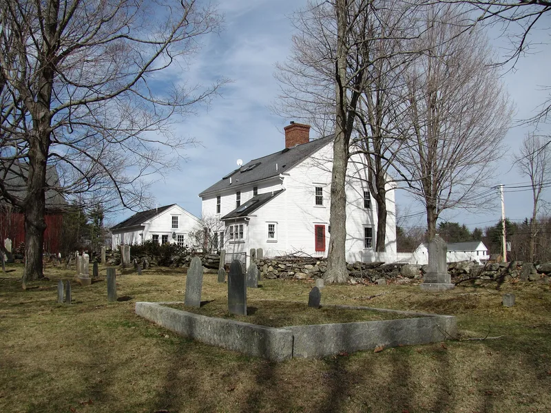
Boxborough Old Town Center is a linear village of about 100 acres on the highest hill in Boxborough, Massachusetts, strung along Hill Road. At its south end lie the remnant of the 1775 town common, the North Burying Ground with about 400 graves, and the granite foundation of the first meetinghouse, which burned in 1953. North of the common, farmhouses from the late 18th and early 19th centuries, including brick Federal residences, sit beside barns, stone walls, farm ponds, hay fields and old cart paths. Two small one-room schoolhouses, one used until 1949, add to the rural setting. The district matters because it holds the surviving institutional, commercial and residential heart of an agricultural town. Civic business was conducted here from 1783 until the Town Hall opened elsewhere in 1901. A well-known general store and meeting hall operated near the common in the early 19th century, and local craftsmen worked nearby. The district also contains the town's best collection of historic farm resources.
Significance in brief: The district preserves the institutional, commercial and residential core of a small New England agricultural town founded in the late 18th century, along with the town's most complete collection of historic farm resources. All civic affairs were conducted here from 1783 until the present Town Hall was built in 1901. Its buildings, cemetery, common and farm landscapes illustrate the town's farming, commercial and civic development.
Machine-generated summary. This summary was generated by a language model from the official nomination document and has not been reviewed line by line by an editor. It may contain errors. Check the source document before relying on any detail. Source: nomination document (PDF) · National Archives catalog entry. NRHP reference 06001122, listed December 12, 2006. Summary generated October 2026 (model claude-sonnet-5-5, prompt v1.0-2026-10-29, confidence medium).
Key facts
| Address | Hill Rd., Middle Rd., Picnic St., Boxborough |
|---|---|
| County | Middlesex County |
| Listed | December 12, 2006 |
| Reference number | 06001122 |
| Resource type | District |
| Architect / builder | Amos Pollard, builder (Lt. Amos Pollard House) |
| Architectural style | Georgian, Federal, mid-19th century, Late Victorian, and 20th-century Ranch and Cape Cod styles |
| Areas of significance | Architecture, Community Planning and Development |
| Level of significance | Local |
| Status (as stated in the nomination) | Retains the character of a rural town center; contains 52 contributing and 20 noncontributing resources, with many houses still used as dwellings and the cemetery and conservation land in current use. |
| Acreage | 100 |
| Coordinates | 42.49675, -71.52793 (NPS GIS) |
What listing means for this property
This is a historic district. Buildings within its boundary are either contributing (they add to the district's significance) or non-contributing. Owners of contributing income-producing buildings can claim the 20% federal rehabilitation tax credit; homeowners should look at state credits. National Register districts impose no design review by themselves; a local historic district ordinance, if one exists, does (the difference explained).
General information, not legal or tax advice. Rules change; confirm with your State Historic Preservation Office or a qualified adviser.
Sources and further reading
- National Park Service, National Register of Historic Places database (snapshot May 2026), reference 06001122.
- Nomination form (PDF, National Archives) — catalog entry
- Wikipedia article (used for cross-checking only; text not reproduced here)
- Wikidata Q4951636
- This listing as JSON
Last updated October 2026. Found an error? See the editorial policy for how to report it.