Ludlow Center Historic District

Why it's listed
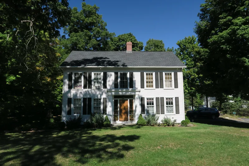
Ludlow Center is a small rural village at the geographic center of Ludlow, Massachusetts, where the town's first meetinghouse and burial ground were placed. Its 27 acres hold twelve buildings, mostly white-clapboarded and modest in scale, with a triangular common at the heart. The 1783-1784 First Meeting House, a late example of the barn-type colonial meetinghouse, anchors the district, alongside Fuller Cemetery, the 1811 Theodore Sikes House, the 1844 Increase Sikes House, an 1865 Greek Revival chapel, an 1866 Italianate house and an 1875 parsonage. Mill development on the Chicopee River from 1810 drew growth to Jencksville, and town meetings and records moved there in 1893. With its civic functions gone, the Center saw almost no development for roughly ninety years. Surrounding wetlands and uplands further insulated it. The area was recognized for its role as the original town center and for its well-preserved village architecture. The district also has archaeological potential.
Significance in brief: It is significant as Ludlow's original town center and the site of the First Meeting House, and as a well-preserved enclave of late 18th and 19th century residences and institutional buildings. After industry shifted the town's focus to Jencksville and Ludlow Village, development bypassed the Center, so it kept its historic character. It meets criteria A and C at the local level.
Machine-generated summary. This summary was generated by a language model from the official nomination document and has not been reviewed line by line by an editor. It may contain errors. Check the source document before relying on any detail. Source: nomination document (PDF) · National Archives catalog entry. NRHP reference 88001999, listed October 21, 1988. Summary generated October 2026 (model claude-sonnet-5-5, prompt v1.0-2026-10-29, confidence high).
Key facts
| Address | Along Center, Church and Booth Sts., Ludlow |
|---|---|
| County | Hampden County |
| Listed | October 21, 1988 |
| Reference number | 88001999 |
| Resource type | District |
| Period of significance | 1783-1912 |
| Architectural style | Colonial - Georgian; Early Republic - Federal; Mid-19th Century - Greek Revival; Late Victorian - Italianate |
| Criteria |
|
| Areas of significance | Community Planning and Development, Architecture |
| Level of significance | Local |
| Status (as stated in the nomination) | Well-preserved rural village. The 1859 church burned in 1980 and was reconstructed in 1982. The Chapel was converted to a private residence in 1935, and the old post office building is still used for that purpose. |
| Acreage | 27 |
| Coordinates | 42.19220, -72.45927 (NPS GIS) |
What listing means for this property
This is a historic district. Buildings within its boundary are either contributing (they add to the district's significance) or non-contributing. Owners of contributing income-producing buildings can claim the 20% federal rehabilitation tax credit; homeowners should look at state credits. National Register districts impose no design review by themselves; a local historic district ordinance, if one exists, does (the difference explained).
General information, not legal or tax advice. Rules change; confirm with your State Historic Preservation Office or a qualified adviser.
Sources and further reading
- National Park Service, National Register of Historic Places database (snapshot May 2026), reference 88001999.
- Nomination form (PDF, National Archives) — catalog entry
- Wikipedia article (used for cross-checking only; text not reproduced here)
- Wikidata Q6698839
- This listing as JSON
Last updated October 2026. Found an error? See the editorial policy for how to report it.