Sunderland Center Historic District

Why it's listed
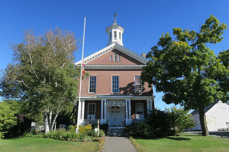
Sunderland Center is a village district on an alluvial flood plain along the east bank of the Connecticut River. A broad main street lined with mature trees runs past large and moderate-sized houses set deep on their lots, with open cultivated land stretching toward the river. The district holds 144 contributing resources, including houses dating from about 1715 into the 1940s, farm outbuildings, commercial buildings, public buildings, a burial ground and a bridge. Its architecture runs from First Period and Georgian houses with saltbox profiles and center chimneys through Federal and Greek Revival buildings, the latter being the best-represented style. Riverside Cemetery, laid out in 1714, holds carved sandstone and slate markers from the 1720s onward. The district was listed because it retains the look of its early 18th-century foundations while showing the agricultural use and gradual change that continued through the first half of the 20th century, with a consistently high level of craftsmanship.
Significance in brief: The district keeps much of its early 18th-century layout and cultivated land, along with a well-preserved collection of houses, farm outbuildings, commercial buildings and public buildings. Its architecture shows consistently high workmanship and reflects the town's agricultural prosperity from the First Period through the early 20th century.
Machine-generated summary. This summary was generated by a language model from the official nomination document and has not been reviewed line by line by an editor. It may contain errors. Check the source document before relying on any detail. Source: nomination document (PDF) · National Archives catalog entry. NRHP reference 02000157, listed March 15, 2002. Summary generated October 2026 (model claude-sonnet-5-5, prompt v1.0-2026-10-29, confidence medium).
Key facts
| Address | Roughly along S. Main St., from Old Amherst Rd. to French's Ferry Rd., Sunderland |
|---|---|
| County | Franklin County |
| Listed | March 15, 2002 |
| Reference number | 02000157 |
| Resource type | District |
| Architectural style | Colonial: Georgian; Early Republic: Federal, Early Classical Revival; Mid-19th century: Greek Revival, Gothic Revival, Italian Villa; Late Victorian: Italianate, Queen Anne, Second Empire; Late 19th century: Colonial Revival, Bungalow |
| Areas of significance | Agriculture, Architecture, Community Planning and Development |
| Level of significance | Local |
| Status (as stated in the nomination) | Current functions listed include domestic, commerce, government, education, religion and agriculture. The district contains 144 contributing and 36 noncontributing resources. |
| Acreage | 108 |
| Coordinates | 42.46856, -72.57980 (NPS GIS) |
What listing means for this property
This is a historic district. Buildings within its boundary are either contributing (they add to the district's significance) or non-contributing. Owners of contributing income-producing buildings can claim the 20% federal rehabilitation tax credit; homeowners should look at state credits. National Register districts impose no design review by themselves; a local historic district ordinance, if one exists, does (the difference explained).
General information, not legal or tax advice. Rules change; confirm with your State Historic Preservation Office or a qualified adviser.
Sources and further reading
- National Park Service, National Register of Historic Places database (snapshot May 2026), reference 02000157.
- Nomination form (PDF, National Archives) — catalog entry
- Wikipedia article (used for cross-checking only; text not reproduced here)
- Wikidata Q14707393
- This listing as JSON
Last updated October 2026. Found an error? See the editorial policy for how to report it.