Charlemont Village Historic District

Why it's listed
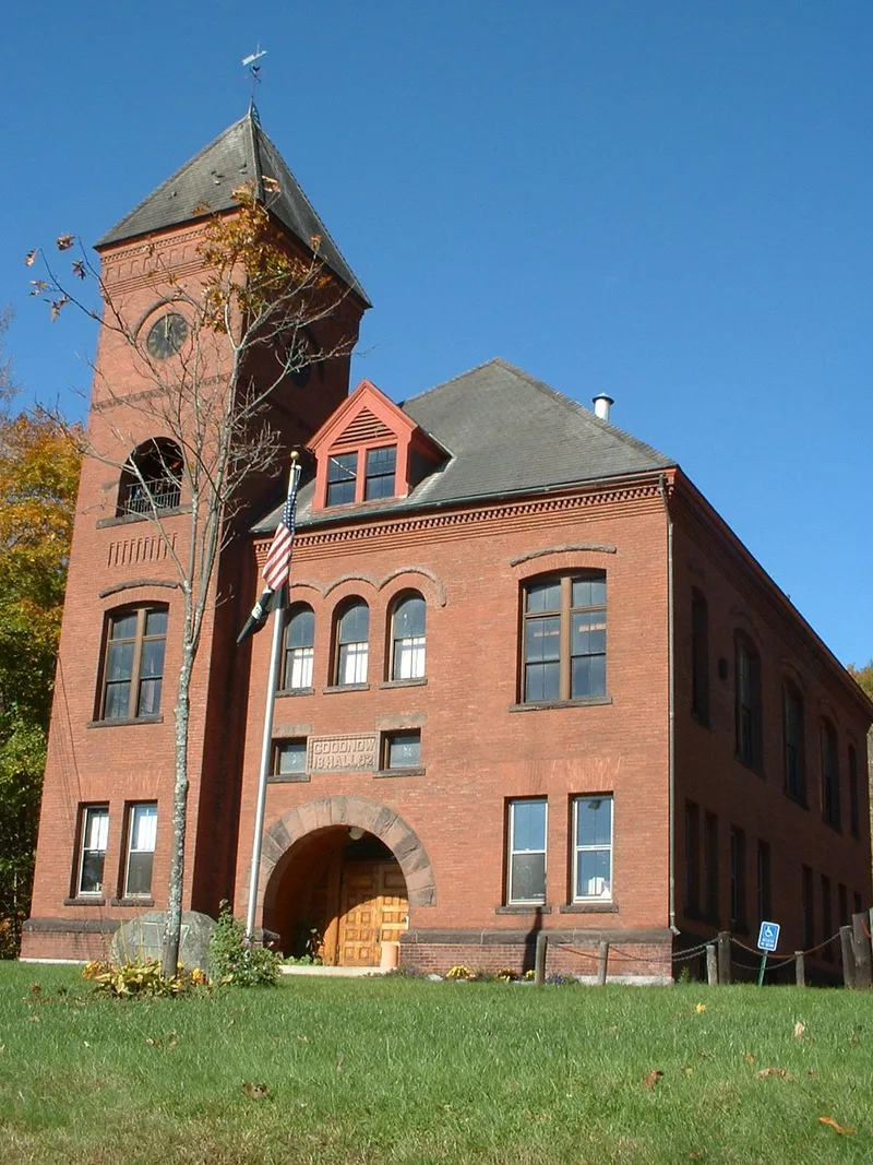
Charlemont Village is a linear settlement of unusual density for rural Massachusetts, stretching about a mile along Main Street (Route 2) beside the Deerfield River. Its 50 acres hold 87 contributing buildings, most of them two-and-a-half-story wood-frame houses, shops and churches put up between 1800 and 1850, many with pedimented end gables and pilastered corners. Greek Revival is the dominant style, with earlier Federal examples such as the Charlemont Inn of about 1787, and later work including the brick Romanesque Revival Goodwin Hall and the Classical Revival high school. The village grew from settlement in the 1740s into a transportation and commercial stop on the Mohawk Trail, with stores, mills, a snath factory and several churches. Its decline followed the construction of Route 2 around 1915. Route widening and a single gas station intrusion have affected its setting, but the historic streetscape remains largely intact. The area also has high potential for prehistoric and historical archaeological remains.
Significance in brief: The district is significant locally for its many well-preserved Greek Revival buildings, along with earlier Colonial and Federal and later Romanesque Revival and Victorian examples. It also reflects the village's role as a transportation and commercial center on the Mohawk Trail, which grew most in the first half of the nineteenth century.
Machine-generated summary. This summary was generated by a language model from the official nomination document and has not been reviewed line by line by an editor. It may contain errors. Check the source document before relying on any detail. Source: nomination document (PDF) · National Archives catalog entry. NRHP reference 87001880, listed February 10, 1988. Summary generated October 2026 (model claude-sonnet-5-5, prompt v1.0-2026-10-29, confidence medium).
Key facts
| Address | MA 2 (Main St.) between South & Harmont Sts., Charlemont |
|---|---|
| County | Franklin County |
| Listed | February 10, 1988 |
| Reference number | 87001880 |
| Resource type | District |
| Period of significance | 1740-1915 |
| Architectural style | Federal; Greek Revival; Late Victorian (Queen Anne, Stick) |
| Criteria |
|
| Areas of significance | Industry, Commerce, Transportation, Exploration/Settlement, Architecture |
| Level of significance | Local |
| Status (as stated in the nomination) | Most structures are largely unaltered, though some are deteriorating; several factory buildings were lost to fire and many mixed-use buildings are now only residences. |
| Acreage | 50 |
| Coordinates | 42.62820, -72.87067 (NPS GIS) |
What listing means for this property
This is a historic district. Buildings within its boundary are either contributing (they add to the district's significance) or non-contributing. Owners of contributing income-producing buildings can claim the 20% federal rehabilitation tax credit; homeowners should look at state credits. National Register districts impose no design review by themselves; a local historic district ordinance, if one exists, does (the difference explained).
General information, not legal or tax advice. Rules change; confirm with your State Historic Preservation Office or a qualified adviser.
Sources and further reading
- National Park Service, National Register of Historic Places database (snapshot May 2026), reference 87001880.
- Nomination form (PDF, National Archives) — catalog entry
- Wikipedia article (used for cross-checking only; text not reproduced here)
- Wikidata Q5074641
- This listing as JSON
Last updated October 2026. Found an error? See the editorial policy for how to report it.