South Green Historic District

Why it's listed
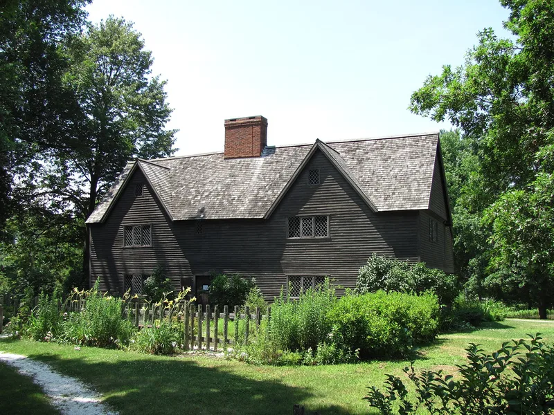
South Green is a district on the southern side of Ipswich's central village in Essex County, Massachusetts. It covers roughly 22 acres and includes 27 structures and a cemetery dating from the seventeenth through nineteenth centuries. The flat green was set off in 1686 to supplement the hilly North or Meeting House Green, and it served as a cattle pasture and militia training field. Schools stood in the area from the mid-1600s through most of the 1800s, and two churches were located here; one survives as the Town Hall, while the South Parish House burned in 1978. The surrounding houses range from the ca. 1655 John Whipple House, a National Historic Landmark, to Federal, Greek Revival, and Second Empire buildings. The Captain Thomas Wade house, ca. 1727, was later occupied by Colonel Nathaniel Wade. The district is well maintained, privately owned, and mixes residential and commercial uses, and its open green is a notable feature.
Significance in brief: The green was set off in 1686 to supplement the hilly North Green and served as cattle pasture and militia training field. It was also the site of schools from the mid-17th century and two churches. It now holds many of Ipswich's finest historic houses and provides open space at the south side of the central village.
Machine-generated summary. This summary was generated by a language model from the official nomination document and has not been reviewed line by line by an editor. It may contain errors. Check the source document before relying on any detail. Source: nomination document (PDF) · National Archives catalog entry. NRHP reference 80000471, listed September 17, 1980. Summary generated October 2026 (model claude-sonnet-5-5, prompt v1.0-2026-10-29, confidence medium).
Key facts
| Address | MA 1A, Ipswich |
|---|---|
| County | Essex County |
| Listed | September 17, 1980 |
| Reference number | 80000471 |
| Resource type | District |
| Architectural style | Mixed styles from the 17th to 19th centuries, including Federal, Greek Revival, Second Empire, and gambrel-roofed colonial houses |
| Areas of significance | Military, Architecture |
| Level of significance | National, State |
| Status (as stated in the nomination) | Area described as well maintained, privately owned, with mixed commercial and residential use. The South Parish House burned in 1978. |
| Acreage | 22 |
| Coordinates | 42.67578, -70.83641 (NPS GIS) |
What listing means for this property
This is a historic district. Buildings within its boundary are either contributing (they add to the district's significance) or non-contributing. Owners of contributing income-producing buildings can claim the 20% federal rehabilitation tax credit; homeowners should look at state credits. National Register districts impose no design review by themselves; a local historic district ordinance, if one exists, does (the difference explained).
General information, not legal or tax advice. Rules change; confirm with your State Historic Preservation Office or a qualified adviser.
Sources and further reading
- National Park Service, National Register of Historic Places database (snapshot May 2026), reference 80000471.
- Nomination form (PDF, National Archives) — catalog entry
- Wikipedia article (used for cross-checking only; text not reproduced here)
- Wikidata Q7567386
- This listing as JSON
Last updated October 2026. Found an error? See the editorial policy for how to report it.