Howe Village Historic District
Also known as: Howe Village
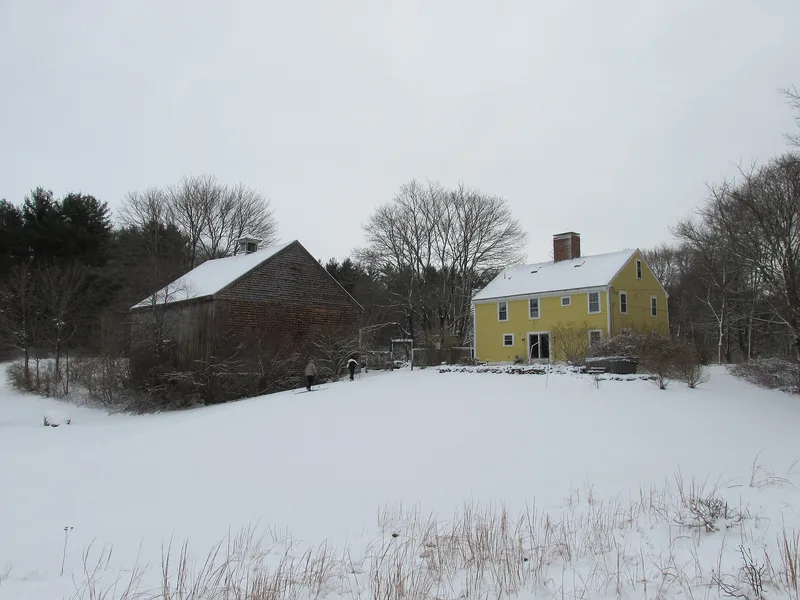

Why it's listed
Howe Village is a roughly 65-acre cluster of homes in Boxford, Massachusetts, set along both sides of Salem Road (Route 97). Of its fourteen structures, eight historic houses stand on the east side of the road, shielded by six 20th-century homes opposite. The earliest is the Thomas Perley House, dated either 1684 or 1760, with others from 1749, 1818 and the 1840s-1850s. Styles run from a saltbox with a center chimney to a Federal farmhouse and Greek Revival dwellings. Salem Road was the first road laid out in Boxford, in 1652, and Thomas Perley ran a tavern here. In 1701 a committee met Native claimants at that tavern and obtained a quitclaim deed to disputed land. The Perley family held town and provincial offices, and the Howe family, for whom the village is named, led its 19th-century shoe manufacturing. The district was also voted a local historic district in 1971, and its houses remain occupied.
Significance in brief: The district is a rural roadside settlement that grew along Boxford's first road (laid out 1652). It is tied to the Perley family and to a 19th-century shoe-making economy led by the Howe family. Its houses show a range of Colonial, Federal and Greek Revival styles, and a 1701 land quitclaim with the Agawam heirs was settled at Thomas Perley's tavern here.
Machine-generated summary. This summary was generated by a language model from the official nomination document and has not been reviewed line by line by an editor. It may contain errors. Check the source document before relying on any detail. Source: nomination document (PDF) · National Archives catalog entry. NRHP reference 73000282, listed April 3, 1973. Summary generated October 2026 (model claude-sonnet-5-5, prompt v1.0-2026-10-29, confidence medium).
Key facts
| Address | NE of Boxford on MA 97, Boxford |
|---|---|
| County | Essex County |
| Listed | April 3, 1973 |
| Reference number | 73000282 |
| Resource type | District |
| Architectural style | Rural Colonial, Federal and Greek Revival dwellings of the 17th to 19th centuries |
| Areas of significance | Industry, Politics/Government, Architecture |
| Level of significance | Local |
| Status (as stated in the nomination) | All dwellings are described as inhabited and in good repair, with no commercial or industrial activity in the village. |
| Acreage | 65 |
| Coordinates | 42.67591, -70.96983 (NPS GIS) |
What listing means for this property
This is a historic district. Buildings within its boundary are either contributing (they add to the district's significance) or non-contributing. Owners of contributing income-producing buildings can claim the 20% federal rehabilitation tax credit; homeowners should look at state credits. National Register districts impose no design review by themselves; a local historic district ordinance, if one exists, does (the difference explained).
General information, not legal or tax advice. Rules change; confirm with your State Historic Preservation Office or a qualified adviser.
Sources and further reading
- National Park Service, National Register of Historic Places database (snapshot May 2026), reference 73000282.
- Nomination form (PDF, National Archives) — catalog entry
- Wikipedia article (used for cross-checking only; text not reproduced here)
- Wikidata Q14715600
- This listing as JSON
Last updated October 2026. Found an error? See the editorial policy for how to report it.