Fort Sewall
Also known as: Marblehead Fort; Fort on Gale's Head

Why it's listed
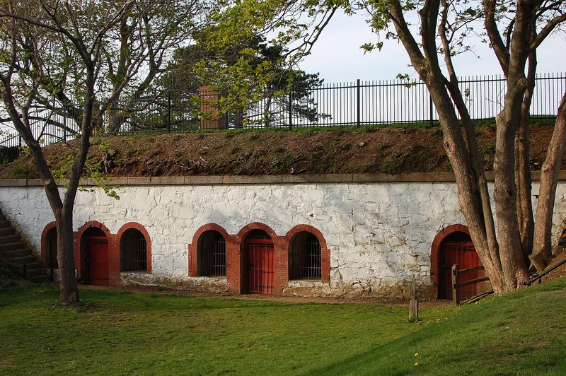
Fort Sewall occupies a rocky promontory on the western side of Marblehead Harbor in Massachusetts. Its origins go back to a breastwork built in 1644 to guard the fishing port against attack from the sea, including threats from the French, the Dutch and pirates. The fort was rebuilt in 1775 and 1776 as tensions with Britain grew, and it was ceded to the new nation in 1794. In 1814 it was renamed for Samuel Sewall, a Chief Justice of the Massachusetts Supreme Court who had lived in Marblehead. That April its guns protected the U.S.S. Constitution as the ship escaped British frigates. The fort was rebuilt again during the Civil War and remained in government hands until 1922, when it was returned to the town. Today it is a public park of about 2.5 acres with a perimeter path overlooking the harbor. Two features of its military past survive: a fifteen-foot earth-covered mound, probably a magazine, and a brick structure measuring 60 by 20 feet.
Significance in brief: The nomination argues that Fort Sewall is an early coastal fort that served as an important military defense for more than three centuries. It was rebuilt for the Revolution, was prominent in the War of 1812 and was rebuilt again in the Civil War. In 1814 its guns helped protect the U.S.S. Constitution from capture by British frigates.
Machine-generated summary. This summary was generated by a language model from the official nomination document and has not been reviewed line by line by an editor. It may contain errors. Check the source document before relying on any detail. Source: nomination document (PDF) · National Archives catalog entry. NRHP reference 75001908, listed April 14, 1975. Summary generated October 2026 (model claude-sonnet-5-5, prompt v1.0-2026-10-29, confidence medium).
Key facts
| Address | Fort Sewall Promontory, Marblehead |
|---|---|
| County | Essex County |
| Listed | April 14, 1975 |
| Reference number | 75001908 |
| Resource type | Site |
| Areas of significance | Military |
| Level of significance | National |
| Status (as stated in the nomination) | Now a public park, ceded back to the town by the federal government in 1922. A mound (probably a magazine) and a brick structure remain from the fort's military use. |
| Acreage | 2.5 |
| Within district | Marblehead Historic District |
| Coordinates | 42.50899, -70.84106 (NPS GIS) |
What listing means for this property
Sites (archaeological sites, battlefields, landscapes) are often listed with a restricted address to protect them from looting or disturbance. Listing is honorary for private owners; federal undertakings on or near the site go through Section 106 review, and state laws may protect burials and artefacts regardless of listing.
General information, not legal or tax advice. Rules change; confirm with your State Historic Preservation Office or a qualified adviser.
Sources and further reading
- National Park Service, National Register of Historic Places database (snapshot May 2026), reference 75001908.
- Nomination form (PDF, National Archives) — catalog entry
- Wikipedia article (used for cross-checking only; text not reproduced here)
- Wikidata Q5472016
- This listing as JSON
Last updated October 2026. Found an error? See the editorial policy for how to report it.