East End Historic District

Why it's listed
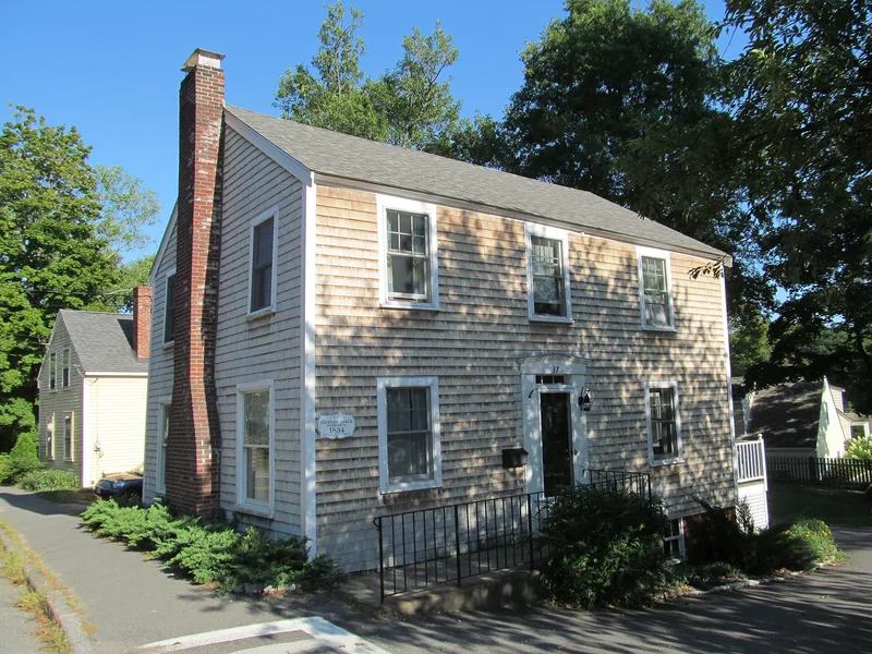
East End is the seafaring quarter of old Ipswich, Massachusetts, lying along the Ipswich River near Town Wharf. Its streets include East, County, Summer, Water, Green and Hovey Streets, Agawam Avenue and part of Turkey Shore Road. Settlers first built against Town Hill, and wharves, warehouses, a customs house, a pottery, a tannery, salt works and shipyards followed. Ship building was an extensive industry by 1676, and staves, clapboards, masts, timbers and fish were shipped abroad. Housing here records the town's growth in distinct phases: building in the 1740s, a lull in the late 18th century reflecting economic hardship, new construction in the 1830s as textile mills succeeded, and a group of Victorian homes on lower County Street after a new bridge opened in 1861. The district is now mostly residential and contains more than sixty surveyed houses, many of them 17th and 18th century timber-frame dwellings, along with a stone arch bridge of the 1870s and a former knitting factory.
Significance in brief: The district shows how Ipswich grew from first settlement through the 19th century, from wharves, shipyards and warehouses on the river to later textile-era and Victorian housing. It holds a large concentration of 17th and 18th century houses, including the home of cabinetmaker Thomas Dennis, along with Greek Revival, Italianate and Second Empire buildings.
Machine-generated summary. This summary was generated by a language model from the official nomination document and has not been reviewed line by line by an editor. It may contain errors. Check the source document before relying on any detail. Source: nomination document (PDF) · National Archives catalog entry. NRHP reference 80000461, listed September 17, 1980. Summary generated October 2026 (model claude-sonnet-5-5, prompt v1.0-2026-10-29, confidence medium).
Key facts
| Address | East St., Ipswich |
|---|---|
| County | Essex County |
| Listed | September 17, 1980 |
| Reference number | 80000461 |
| Resource type | District |
| Period of significance | 17th-19th centuries |
| Architectural style | Mixed 17th-19th century styles, including First Period timber-frame houses, Georgian, Greek Revival, Italianate, Second Empire and Gothic Revival |
| Areas of significance | Exploration/Settlement, Architecture |
| Level of significance | National, State |
| Status (as stated in the nomination) | Predominantly residential, with over 60 fully surveyed houses and additional secondary contributors; maintenance varies. |
| Acreage | 53 |
| Coordinates | 42.68266, -70.83165 (NPS GIS) |
What listing means for this property
This is a historic district. Buildings within its boundary are either contributing (they add to the district's significance) or non-contributing. Owners of contributing income-producing buildings can claim the 20% federal rehabilitation tax credit; homeowners should look at state credits. National Register districts impose no design review by themselves; a local historic district ordinance, if one exists, does (the difference explained).
General information, not legal or tax advice. Rules change; confirm with your State Historic Preservation Office or a qualified adviser.
Sources and further reading
- National Park Service, National Register of Historic Places database (snapshot May 2026), reference 80000461.
- Nomination form (PDF, National Archives) — catalog entry
- Wikipedia article (used for cross-checking only; text not reproduced here)
- Wikidata Q5328305
- This listing as JSON
Last updated October 2026. Found an error? See the editorial policy for how to report it.