Daddy Frye's Hill Cemetery

Why it's listed
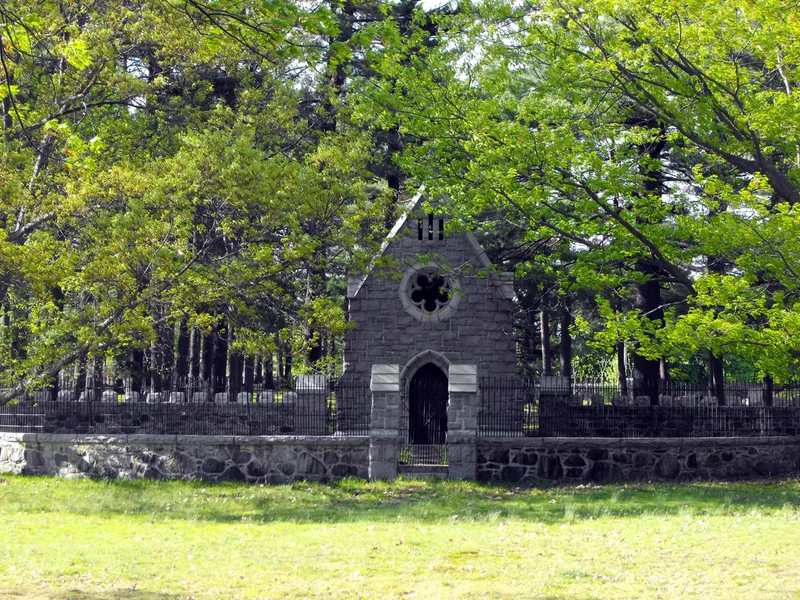
Daddy Frye's Hill Cemetery occupies 2.4 acres at East and Brook Streets in Methuen, Massachusetts. The town voted in 1728 to lay out the burial ground beside its newly established Congregational meetinghouse, in what was then the original town center. The area later took the name Daddy Frye's Hill from Jeremiah Frye, who ran a nearby tavern. The site is gently rolling, grassed and dotted with mature conifers. About 250 slate and marble stones, all facing west, carry typical 18th and 19th century motifs such as winged death's heads, cherubs, urns and willows. The earliest death date is 1728. In the late 19th century, Methuen millionaire Edward F. Searles built a chapel-like tomb as a memorial to his uncle and aunt, Mr. and Mrs. Artemas W. Stearns, and enclosed most of the cemetery with a high granite wall. It was listed as the major surviving feature of Methuen's early town center and for its Searles associations. The cemetery remains in generally good condition.
Significance in brief: The nomination argues it is the major surviving feature of Methuen's early town center. It is also tied to the Searles family through the late 19th-century tomb and granite wall built by Edward F. Searles. It is said to retain integrity of location, design, setting, materials and workmanship.
Machine-generated summary. This summary was generated by a language model from the official nomination document and has not been reviewed line by line by an editor. It may contain errors. Check the source document before relying on any detail. Source: nomination document (PDF) · National Archives catalog entry. NRHP reference 84002320, listed January 20, 1984. Summary generated October 2026 (model claude-sonnet-5-5, prompt v1.0-2026-10-29, confidence medium).
Key facts
| Address | East and Arlington Sts., Methuen |
|---|---|
| County | Essex County |
| Listed | January 20, 1984 |
| Reference number | 84002320 |
| Resource type | Site |
| Architect / builder | Edward F. Searles (tomb and granite wall, late 19th century) |
| Criteria |
|
| Areas of significance | Community Planning and Development, Art |
| Level of significance | Local |
| Status (as stated in the nomination) | Generally good condition, with few broken or overturned stones; owned by the Town of Methuen. |
| Acreage | 2.4 |
| Coordinates | 42.72547, -71.16563 (NPS GIS) |
What listing means for this property
Sites (archaeological sites, battlefields, landscapes) are often listed with a restricted address to protect them from looting or disturbance. Listing is honorary for private owners; federal undertakings on or near the site go through Section 106 review, and state laws may protect burials and artefacts regardless of listing.
General information, not legal or tax advice. Rules change; confirm with your State Historic Preservation Office or a qualified adviser.
Sources and further reading
- National Park Service, National Register of Historic Places database (snapshot May 2026), reference 84002320.
- Nomination form (PDF, National Archives) — catalog entry
- Wikipedia article (used for cross-checking only; text not reproduced here)
- Wikidata Q5208012
- This listing as JSON
Last updated October 2026. Found an error? See the editorial policy for how to report it.