Gay Head Light

Why it's listed
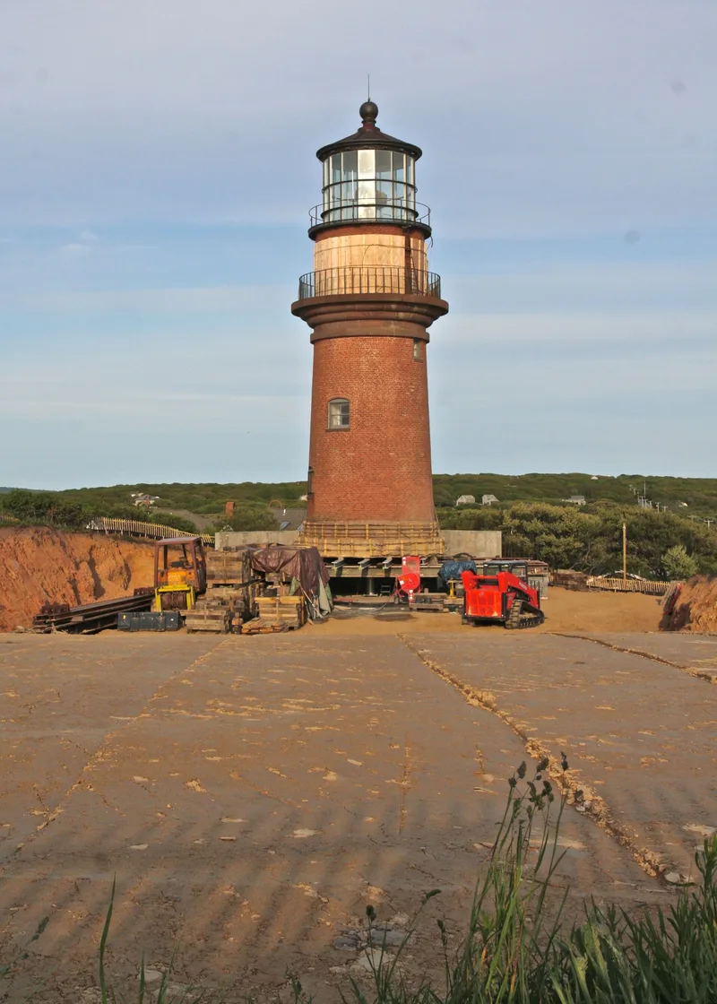
Gay Head Light is a brick lighthouse completed in 1856 on the red clay cliffs at the western end of Martha's Vineyard. Built for $15,000, the tower is 45 feet 8 inches tall and 17 feet 6 inches in diameter. A band of brownstone blocks girdles its middle, and an iron lens room with floor-to-ceiling glazing sits at the top, closely resembling the design of Highland Light in Truro. Inside, a spiral cast-iron staircase winds around a central core. The light warns vessels away from the Devil's Bridge rocks and the south shore shoals and guides traffic into Vineyard Sound. It was considered one of the ten most important lights on the Atlantic Coast and first held a first-order Fresnel lens. Operation became unmanned in 1956, and the keeper's house and other buildings were removed by 1961, leaving the tower alone. It was listed for its role in the development of navigation aids and for its architecture.
Significance in brief: The tower is the most conspicuous historic structure in the town and marks Devil's Bridge rocks, the south shore shoals and the entrance to Vineyard Sound. When built it was considered one of the ten most important lights on the Atlantic Coast and was equipped with one of the first Fresnel lenses in the country. It retains integrity of location, design, setting, materials and workmanship.
Machine-generated summary. This summary was generated by a language model from the official nomination document and has not been reviewed line by line by an editor. It may contain errors. Check the source document before relying on any detail. Source: nomination document (PDF) · National Archives catalog entry. NRHP reference 87001464, listed June 15, 1987. Summary generated October 2026 (model claude-sonnet-5-5, prompt v1.0-2026-10-29, confidence high).
Key facts
| Address | 15 Aquinnah Cir., Aquinnah |
|---|---|
| County | Dukes County |
| Listed | June 15, 1987 |
| Reference number | 87001464 |
| Resource type | Structure |
| Criteria |
|
| Areas of significance | Engineering, Transportation, Architecture, Maritime History |
| Level of significance | State |
| Status (as stated in the nomination) | Unmanned and active; the 1856 tower is the only remaining structure, as the keeper's house and Coast Guard buildings were demolished in 1959 and 1961. |
| Acreage | 2 |
| Coordinates | 41.35075, -70.83790 (NPS GIS) |
What listing means for this property
National Register listing is honorary: it recognises significance and does not restrict what a private owner may do without federal money or permits. It unlocks the 20% federal rehabilitation tax credit for income-producing buildings, state credits in many states, and Section 106 review when federal agencies are involved. See what listing means in practice.
General information, not legal or tax advice. Rules change; confirm with your State Historic Preservation Office or a qualified adviser.
Sources and further reading
- National Park Service, National Register of Historic Places database (snapshot May 2026), reference 87001464.
- Nomination form (PDF, National Archives) — catalog entry
- Wikipedia article (used for cross-checking only; text not reproduced here)
- Wikidata Q5528593
- This listing as JSON
Last updated October 2026. Found an error? See the editorial policy for how to report it.